 Our first stop was in Dubai, where we spent 5 days enjoying the city.
Here a view of our hotel in Dubai from the 5th floor overlooking the central ground floor area. Beautiful mural.
The hotel was called the Battuta Gate Hotel. It is located in the south of the city, but everything
is pretty central in Dubai.
Good hotel if you're looking for a recommendation, although as I say, it's not
central to to the city, but about 1/2 hour south.
 A picture of the Battuta Gate Hotel from the outside. Interesting architecture, in that the hotel spans
a road. Our room was not on over the street unfortunetly, but to the right of the picture.
A picture of the Battuta Gate Hotel from the outside. Interesting architecture, in that the hotel spans
a road. Our room was not on over the street unfortunetly, but to the right of the picture.
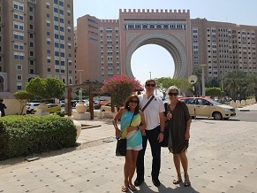
There was mall and a subway stop in short walking distance from the hotel, so it was a good overall location. Here
is a pic of Bill with Adelina and our traveling companion on the trip Mimi. View is from mall across from hotel.
 A view of our hotel; Battuta Gate Hotel, at night.
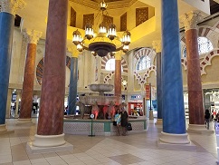 This is a pic of the main entrance to the mall across the street from our hotel in Dubai. Most of Dubai is fresh
and ornate and new. You must remember that 30 years ago, Dubai was a desert. In 30 years it has sprung from a nomatic
dominated desert to a model city and popular tourist destination.
This is a pic of the main entrance to the mall across the street from our hotel in Dubai. Most of Dubai is fresh
and ornate and new. You must remember that 30 years ago, Dubai was a desert. In 30 years it has sprung from a nomatic
dominated desert to a model city and popular tourist destination.
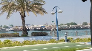
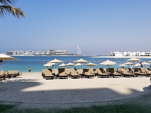 Beautiful view of a local beach overlooking the Persian Gulf. Dubai in part of the UAE; United Arab Emirates. In the
distance you can see the iconic Burj Al Arab Jumeirah hotel, that looks like a giant ships sail. Commemorating Dubai's
association with the sea, and the resort lifestyle.
Beautiful view of a local beach overlooking the Persian Gulf. Dubai in part of the UAE; United Arab Emirates. In the
distance you can see the iconic Burj Al Arab Jumeirah hotel, that looks like a giant ships sail. Commemorating Dubai's
association with the sea, and the resort lifestyle.
Also, note on a map that the EAE is almost exactly on the point on the Saudia Arabia side of the Straight of Hormuz. This
is that very narrow straight in the Persian Gulf where much of the worlds oil passes through from the middle east to the
remainder of the world. This picture, way in the distance, is the straight.
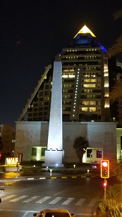
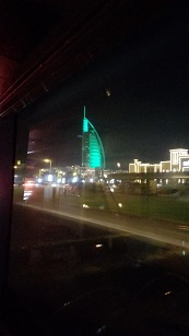 A pic of the Burj Al Arab Jumeriah hotel at night, beautifully lit.
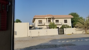 Here we have a pic of a typical home for an upscale resident of Dubai. Amost all these well-to-do home owners
have wall around their homes though. There doesn't seem to be crime in Dubai, and a tour guide told us that
the only prison in the UAE country is empty. Amost everyone in the country are workers or tourists, with only
11.1% of the residents being citizens; and these are well taken care of by the government.
Here we have a pic of a typical home for an upscale resident of Dubai. Amost all these well-to-do home owners
have wall around their homes though. There doesn't seem to be crime in Dubai, and a tour guide told us that
the only prison in the UAE country is empty. Amost everyone in the country are workers or tourists, with only
11.1% of the residents being citizens; and these are well taken care of by the government.
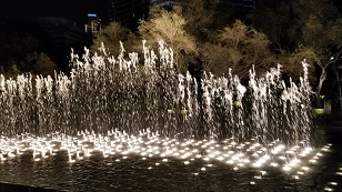 A public, free, on-the-sidewalk, dancing water display in downtown Dubai.
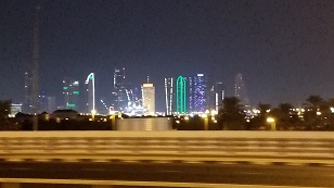 A portion of the Dubai skyline at night. Everthing is intended to be first class in Dubai and the wonderful
lighting of the various buildings, I'm sure, are not a coincidence. Spectacular!
A portion of the Dubai skyline at night. Everthing is intended to be first class in Dubai and the wonderful
lighting of the various buildings, I'm sure, are not a coincidence. Spectacular!
 A popular mall (and there are LOT'S of malls in Dubai) called Wafi. This mall has a theme (not all are themed). This
one fancies itself after Egypt. Other areas of the mall have statues, obelisks, etc.
A popular mall (and there are LOT'S of malls in Dubai) called Wafi. This mall has a theme (not all are themed). This
one fancies itself after Egypt. Other areas of the mall have statues, obelisks, etc.
We never went inside this particular mall. We saw it from a hop-on-hop-off stop. We're told it's an expensive mall.
Probably why we didn't go in...
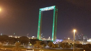 Now here is another, rather iconic, building in Dubai. Called the "Dubai Frame". You can't always get perspective from
a picture necessarily, but this structure is huge, like the St. Louis Arch in the U.S. There is a restaurant and observation deck on top. No doubt an attempt to make a place in Dubai like The Eiffel Tower, or St. Louis Arch, etc.
Now here is another, rather iconic, building in Dubai. Called the "Dubai Frame". You can't always get perspective from
a picture necessarily, but this structure is huge, like the St. Louis Arch in the U.S. There is a restaurant and observation deck on top. No doubt an attempt to make a place in Dubai like The Eiffel Tower, or St. Louis Arch, etc.
Time didn't allow us an opportunity to go into The Frame. But we saw Dubai skyline views from other venues and,
while I'm sure the restuarant is great, we saw plenty of great resturants. So this one was probably OK to skip.
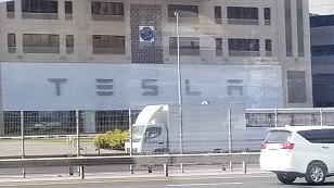 Big Tesla sales and service facility in Dubai. Bodes to the technology that Dubai brings to the gulf region.
Saw a number of Tesla's on the road. The city is working to implement much state-of-the-art facilities.
Big Tesla sales and service facility in Dubai. Bodes to the technology that Dubai brings to the gulf region.
Saw a number of Tesla's on the road. The city is working to implement much state-of-the-art facilities.
Speaking of Elon Musk, his project, the Hyperloop, is scheduled to be installed in Dubai in the next couple of years. Traffic in Dubai causes it to take about 45 minutes to go from north to south. The Hyperloop, when operating, will do the job in 12 minutes, we're told.
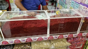 In going to some of the shops and stores in street areas (not malls) in Dubai, we came across this. A HUGE display
of Saffron. If you know the spice Safferon, it is VERY expensive here in the U.S. Yet here, there are "tons" of
it for sale, and cheaply. Wow! The stuff must be grown in this area.
In going to some of the shops and stores in street areas (not malls) in Dubai, we came across this. A HUGE display
of Saffron. If you know the spice Safferon, it is VERY expensive here in the U.S. Yet here, there are "tons" of
it for sale, and cheaply. Wow! The stuff must be grown in this area.
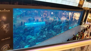 Is this interesting or what! Picture here of the "Dubai Mall". One of the main and popular ones in the city. There is,
can you believe it, a two story wall in the mall, that is a fish tank! Check out the pic. It is taken from the second
floor looking down at the tank and the first floor beyond.
Is this interesting or what! Picture here of the "Dubai Mall". One of the main and popular ones in the city. There is,
can you believe it, a two story wall in the mall, that is a fish tank! Check out the pic. It is taken from the second
floor looking down at the tank and the first floor beyond.
You can see the fish in the tank, and the people beyond on the first floor. Spectaular. God help everyone though if the glass ever breaks. No earthquakes in the Dubai area that I'm aware of. Wouldn't suggest this setup in Los Angeles or San Francisco.
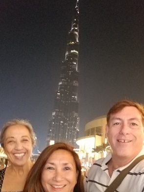 A selfie pic of our little group; Bill, Adelina, and Mimi. In the background is the famous Burj Khalifa, the tallest
building in the world (at least when we visited in October, 2018). Beautiful view of the building from a cental tourist
and shipping area of the Dubai Mall. The Burj Khalifa is named after the leader of the UAE, Sheikh Khalifa bin Zayed.
A selfie pic of our little group; Bill, Adelina, and Mimi. In the background is the famous Burj Khalifa, the tallest
building in the world (at least when we visited in October, 2018). Beautiful view of the building from a cental tourist
and shipping area of the Dubai Mall. The Burj Khalifa is named after the leader of the UAE, Sheikh Khalifa bin Zayed.
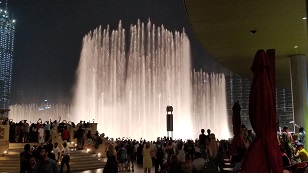 Very nice dancing water display, runs every hour, at the Dubai Mall area.
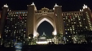
 Beautiful view of the Atlantis hotel in Dubai. With the trees in the foreground, it has the mystical flavor
that we all vision of the mythical Atlantis island, lost in the sea.
Beautiful view of the Atlantis hotel in Dubai. With the trees in the foreground, it has the mystical flavor
that we all vision of the mythical Atlantis island, lost in the sea.
The hotel is home to a private beach, swimming with dolphins, theatres, and a number of other entertainment venues.
One would not have to leave this hotel to enjoy youself, unless you wanted to see the greater Dubai area. The hotel
is on reclamined land, as is much of the high-end resorts in the area.
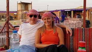
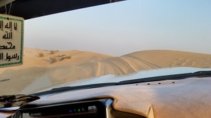 So, when is Rome, do as the Romans do... when in Hawaii, you do a Luau. Well.. when in Dubai, you MUST do the
Sand Dune Safari's. They take you out in the middle of noware. They give you a crazy dune ride on the sand dunes.
Then dinner is (what they says is) an old Bedouin camp like the old days, along with belly dancing entertainment.
So, when is Rome, do as the Romans do... when in Hawaii, you do a Luau. Well.. when in Dubai, you MUST do the
Sand Dune Safari's. They take you out in the middle of noware. They give you a crazy dune ride on the sand dunes.
Then dinner is (what they says is) an old Bedouin camp like the old days, along with belly dancing entertainment.
Here we're getting our sand dune ride... Quite a ride. Vehicle was an SUV type deal, not a dune buggy (too bad).
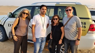 After we survived our sand dune crazy ride, we got a picture with our group, our fearless driver, and our faithful
steed that took the dunes.
After we survived our sand dune crazy ride, we got a picture with our group, our fearless driver, and our faithful
steed that took the dunes.
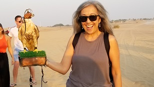 Picture of Mimi with a local bird (falcon?) Seems nice enough. I'm sure it helps that his eyes are covered and
he can't see a thing. Probably helpful for us too.
Picture of Mimi with a local bird (falcon?) Seems nice enough. I'm sure it helps that his eyes are covered and
he can't see a thing. Probably helpful for us too.
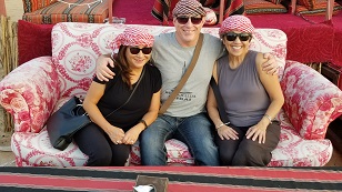 Here is Bill with his Dubai Herum at our Bedouin camp.
 We shared our tent with another guy and his (smaller) herum. These folks are from the U.S. visiting as we were and
we had a great time with them.
We shared our tent with another guy and his (smaller) herum. These folks are from the U.S. visiting as we were and
we had a great time with them.
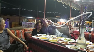 So while my buddy from the U.S. and I hang with our herums, we smoke the traditional hookah. It uses hot coal on the
top of the device and water and the bottom. Mixes with tobacco in the middle when you inhale, to get smoke. Occassionally, people come by and replace the hot coal as it cools and the Hookah stops working.
So while my buddy from the U.S. and I hang with our herums, we smoke the traditional hookah. It uses hot coal on the
top of the device and water and the bottom. Mixes with tobacco in the middle when you inhale, to get smoke. Occassionally, people come by and replace the hot coal as it cools and the Hookah stops working.
In addition to entertainment, the hookah, and the herum, we enjoy traditional bedouin food.
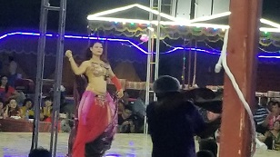 One of the belly dancers entertaining us while we eat traditional bedouin food, smoke the Hookah, and enjoy my herum.
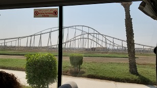
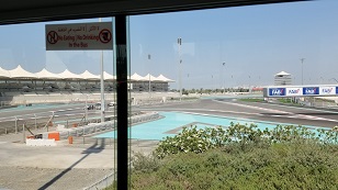 After our nighly adventures in the Dubai desert, we take a tour of Abu Dhabi. One stop is the area of the Yas Marina
Circuit. This is the site of the Abu Dhabi Grand Prix, which you can see in the picture.
After our nighly adventures in the Dubai desert, we take a tour of Abu Dhabi. One stop is the area of the Yas Marina
Circuit. This is the site of the Abu Dhabi Grand Prix, which you can see in the picture.
 Also in the area of the Yas Marina Grand Prix is Ferrari World. This is a entertainment area for young poeple, with
roller coasters, games, some Disneyland-like rides, etc.
Also in the area of the Yas Marina Grand Prix is Ferrari World. This is a entertainment area for young poeple, with
roller coasters, games, some Disneyland-like rides, etc.
Here our intrepid group get a selfie at the enterance to the place.
 One of the biggest (we're told) roller coasters in the world at Ferrari World, including a loop that is shaped like a heart.
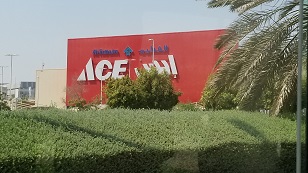 On our Abu Dhabi tour... Central Abu Dhabi is about 2 hours south of downtown Dubai. We are inn the Abu Dhabi Grand Prix area and the Ferrari World entertainment center. So far from away, and we find an icon of home.. an Ace Hardware store!
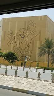 Also in the area of the Abu Dhai Grand Prix and the Ferrari World area, is a Disney entertainment center. Like
Univeral Studio's entertainment area in Los Angeles, where people can go for tours and other kinds of Disney
entertainment venues. On the building are caricature's of Disney characters.
Also in the area of the Abu Dhai Grand Prix and the Ferrari World area, is a Disney entertainment center. Like
Univeral Studio's entertainment area in Los Angeles, where people can go for tours and other kinds of Disney
entertainment venues. On the building are caricature's of Disney characters.
We snap a pic of the caricature of the Tasmanian Devil, which takes us back to our Australian trip in January, 2018, when we visited Tasmania and a REAL Tasmanian Devil.
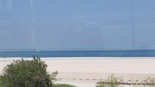 This area we are touring, where the Abu Dhabi GrandPrix, Ferrari World, and Disney Entertainment Center (amonst other
venues) is located, is called the Yas Marina. The entire area is all on reclaimed land. This pic is on the coast and we are looking into the Persian Golf. The straight of Hormuz is out there somewhere.
This area we are touring, where the Abu Dhabi GrandPrix, Ferrari World, and Disney Entertainment Center (amonst other
venues) is located, is called the Yas Marina. The entire area is all on reclaimed land. This pic is on the coast and we are looking into the Persian Golf. The straight of Hormuz is out there somewhere.
 On our intrepid tour of Abu Dhabi, we are taken to the Louve, Abu Dhabi. It's intended to be a museum on the calibur
of the Louve in Paris, and actually these two museums have an agreement to share artifacts and displays.
On our intrepid tour of Abu Dhabi, we are taken to the Louve, Abu Dhabi. It's intended to be a museum on the calibur
of the Louve in Paris, and actually these two museums have an agreement to share artifacts and displays.
Here is a picture of the museum on our approach. A dome instead of a pyramid like in Paris.
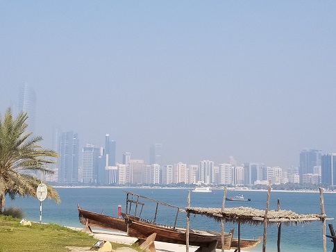
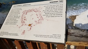
 Pic of the Abu Dhabi main harbor area. The boats in the foreground are boats of local fishermen. Same types of
boats used in the "old" days before the UAE put itself on the map.
Pic of the Abu Dhabi main harbor area. The boats in the foreground are boats of local fishermen. Same types of
boats used in the "old" days before the UAE put itself on the map.
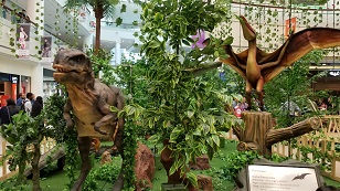 In doubtown Abu Dhabi, we stop for lunch at the popular Al Wahda Mall. In the center of the mall, they have
animatronics displays of dinosours. Very popular with the kids and adults. Here we see a Velociraptor and a
Pterodactyls, awaiting to also have lunch, of an unsuspecting visitor.
In doubtown Abu Dhabi, we stop for lunch at the popular Al Wahda Mall. In the center of the mall, they have
animatronics displays of dinosours. Very popular with the kids and adults. Here we see a Velociraptor and a
Pterodactyls, awaiting to also have lunch, of an unsuspecting visitor.
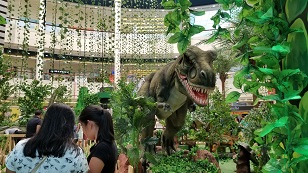 Another view of the animatronics dinosour display at the Abu Dhabi Al Wahda Mall display. Here we have a T-Rex
planning on making lunch out of those unspecting ladies in the foreground. As the guy on the original Jurassic
Park movie that fed the dinosaurs said.. "Feed T-Rex!"
Another view of the animatronics dinosour display at the Abu Dhabi Al Wahda Mall display. Here we have a T-Rex
planning on making lunch out of those unspecting ladies in the foreground. As the guy on the original Jurassic
Park movie that fed the dinosaurs said.. "Feed T-Rex!"
 As we tour the Abu Dhabi metro area, we stop at an tributary into the city from the Persian Gulf. Here is a beautiful
view of the greater Abu Dhabi city. Lot's of sky scrapers in this land, that's for sure.
As we tour the Abu Dhabi metro area, we stop at an tributary into the city from the Persian Gulf. Here is a beautiful
view of the greater Abu Dhabi city. Lot's of sky scrapers in this land, that's for sure.
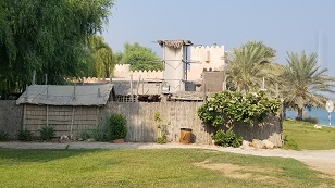 Now here we have the outside and entrance to Bait Al Sahel, or "The Coast People". This is a reconstruction - for tourists - of the settlements and living conditions of people in this area before the identification of oil in the area,
and U.S. companies throwing billions of dollars into the region to extract the oil from these people, who owned the land.
Now here we have the outside and entrance to Bait Al Sahel, or "The Coast People". This is a reconstruction - for tourists - of the settlements and living conditions of people in this area before the identification of oil in the area,
and U.S. companies throwing billions of dollars into the region to extract the oil from these people, who owned the land.
Interesting in that only 2 or 3 generations ago, the current people of the UAE lived like this. Now, just 70-100 years later, they are living like (and in some cases are) kings.
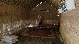 Here is a picture of the inside of one of the residences (huts?) in the village shown in the picture above (minus the A/C unit on the wall.. it's so hot, they need to cool these places a little for the tourists). These people lived close to the sea and local goats, camaels and fish were their diet, plus whatever they managed to grow.
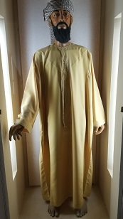 There is a little museum on the property of this little tourist town that shows what one of the more well-to-do dudes wore at the time.
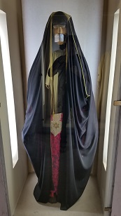 Also a well-to-do woman of the village above. Note that even then, they were almost totally covered up. With all the
heat and humidity, it couldn't be comfortable. Even in A/C, that get-up can't be good wearables.
Also a well-to-do woman of the village above. Note that even then, they were almost totally covered up. With all the
heat and humidity, it couldn't be comfortable. Even in A/C, that get-up can't be good wearables.
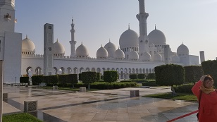
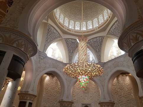
 Our final stop on our grand Abu Dhabi tour is the Sheik Zayad Grand Mosque. Shiek Zayed was the father of the current
UAE ruler and the one that created the vision and plan for what the UAE is today. He is a revered character. This
grand mosque was named for him and is one of the finest (if not THE finest) in the UAE. So the tours stop here. While
Mosque's are not my thing in general, taking a look at one was very educational.
Our final stop on our grand Abu Dhabi tour is the Sheik Zayad Grand Mosque. Shiek Zayed was the father of the current
UAE ruler and the one that created the vision and plan for what the UAE is today. He is a revered character. This
grand mosque was named for him and is one of the finest (if not THE finest) in the UAE. So the tours stop here. While
Mosque's are not my thing in general, taking a look at one was very educational.
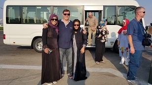
Now here in this pic, we stop at the parking lot. But the women need to be dressed in the traditional hijab get-up. Here my ladies I'm traveling with don some that they rented from the driver for a few American bucks.
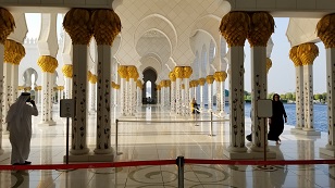
 Here is an outside view of one side of the Shiek Zayed Grand Mosque. It's a pretty big place. The arches surround an
outside corridor that leads from the entry location on the left to the mosque itself on the right. For some reason, this
corridor (on the right as you enter the mosque on the left) was not used. Everyone used on the one on the left side.
Here is an outside view of one side of the Shiek Zayed Grand Mosque. It's a pretty big place. The arches surround an
outside corridor that leads from the entry location on the left to the mosque itself on the right. For some reason, this
corridor (on the right as you enter the mosque on the left) was not used. Everyone used on the one on the left side.
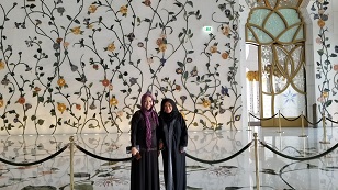
 Now here is a pic, with the girls kind of in the dark due to lighting, of the inside courtyard of the mosque. The
picture above was taken on the outside, near the corner opposite where this picture was taken (in the background
above the girls heads). The entryway to the mosque is the background, center of picture.
Now here is a pic, with the girls kind of in the dark due to lighting, of the inside courtyard of the mosque. The
picture above was taken on the outside, near the corner opposite where this picture was taken (in the background
above the girls heads). The entryway to the mosque is the background, center of picture.
Now the courtyard looks like there is water on the ground, but it's actually marble and highly polished. No water there. So this place is well respected and well taken care of by the local people.
 Here is a picture down the arched walkway on the left side, from where you enter the mosque.
 Here is a view inside the back of the mosque at the entry to the mosque itself. The courtyard in the picture above
is just outside to the right of picture. Entrance to the mosque itself is to the left.
Here is a view inside the back of the mosque at the entry to the mosque itself. The courtyard in the picture above
is just outside to the right of picture. Entrance to the mosque itself is to the left.
 Here is a pretty good pic inside the mosque, that gives a good flavor to the opulence of the place. The area
inside the mosque is basically open because, I believe, the people that come bring their prayer rugs that they lay
on the open floor. So funiture, like pews, are not needed.
Here is a pretty good pic inside the mosque, that gives a good flavor to the opulence of the place. The area
inside the mosque is basically open because, I believe, the people that come bring their prayer rugs that they lay
on the open floor. So funiture, like pews, are not needed.
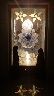 Now this picture I really like. The girls are framed on a mosque window. The light coming in silhouettes the girls,
creating a very interesting picture. It looks like Obi-Wan Kenobi and Anakin Skywalker having a discussion about the force.
Now this picture I really like. The girls are framed on a mosque window. The light coming in silhouettes the girls,
creating a very interesting picture. It looks like Obi-Wan Kenobi and Anakin Skywalker having a discussion about the force.
 Our tour of Abu Dhabi done, we are heading back to our hotel in Dubai. It's evening now. Pretty much all of the
mosques - and boy there are tons of them in the UAE - are light up at night. Here is one we snapped from the highway.
Our tour of Abu Dhabi done, we are heading back to our hotel in Dubai. It's evening now. Pretty much all of the
mosques - and boy there are tons of them in the UAE - are light up at night. Here is one we snapped from the highway.
 We are finally in Israel on our trip. We arrive in Tel Aviv in the afternoon, are picked up by the MorningStar
tour group, and make it to our hotel in Netanya. Netanya is west of Tel Aviv, along the mediterranean coast.
We are finally in Israel on our trip. We arrive in Tel Aviv in the afternoon, are picked up by the MorningStar
tour group, and make it to our hotel in Netanya. Netanya is west of Tel Aviv, along the mediterranean coast.
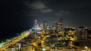
We get ourselves checked in and settled in, in a room high up in the hotel. We relax and enjoy the lights of the city
of Netanya. The beach and the mediterranean are on the left of the picture.
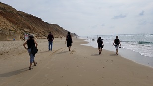 The next morning, while we wait for all of our tour group arrive, we take a walk on the beach with some of our group that have already arrived. Our hotel is to the left as we walk south.
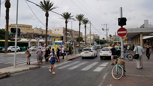 We take a trip to downtown Netanya for a little sightseeing and shopping. Here is a street view in the city.
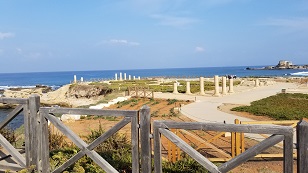
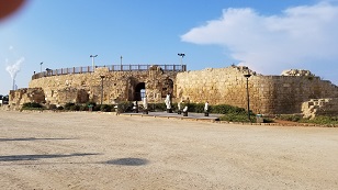 Our first sightseeing vist of the tour is up the coast from Netanya, to the ruins of Caesarea. Caesarea, during
Jesus' time was the main city of Roman government in Judea (the Israel area). It was named after Caeser by Herrod
the Great.
Our first sightseeing vist of the tour is up the coast from Netanya, to the ruins of Caesarea. Caesarea, during
Jesus' time was the main city of Roman government in Judea (the Israel area). It was named after Caeser by Herrod
the Great.
To the left, are the ruins of the outside of the city amphitheatre. There was always one in big Roman towns.
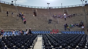 This picture is the inside of the Caesarea amphitheatre, from the focal point in the front, where a Roman person would
address the crowd. With the accounstics set as they build them, talking loud, you could be heard from anywhere inside
the seating area!
This picture is the inside of the Caesarea amphitheatre, from the focal point in the front, where a Roman person would
address the crowd. With the accounstics set as they build them, talking loud, you could be heard from anywhere inside
the seating area!
In Acts, it is discussed that Paul had an audiance with Herrod Antipas here. He would have stood very close to where
this picture was taken and saw the same view of the amphitheatre (minus the people and the chairs, of course!) and with the addition of the buildings completed, instead of ruins.
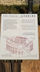 The picture of the display at the site of the Caeserea amphitheatre ruins show what they believe the entire theatre area might have looked like during Jesus' and Paul's time.
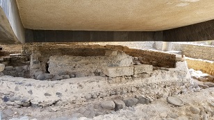
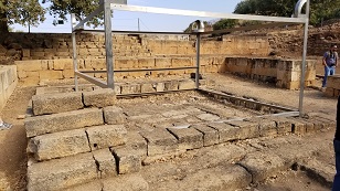
 In the ancient city of Caeserea, Herrod the Great built a palace for himself here. Recent archaeological digs have
unearthed the ruins of the palace, some of which are in this picture.
In the ancient city of Caeserea, Herrod the Great built a palace for himself here. Recent archaeological digs have
unearthed the ruins of the palace, some of which are in this picture.
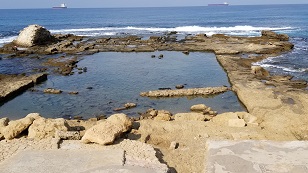 Herrod the Great insisted that he have a swimming pool at his Caeserea palace. And not only that, he wanted fresh
water in the pool. Subsequent pictures will see the aqueduct that the Romans built to supply water to the city and
would have been used for Harrod's swimming pool also.
Herrod the Great insisted that he have a swimming pool at his Caeserea palace. And not only that, he wanted fresh
water in the pool. Subsequent pictures will see the aqueduct that the Romans built to supply water to the city and
would have been used for Harrod's swimming pool also.
This picture is the ruins of the swimming pool at the palace.
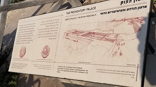 To the right is a drawing at the ruins of Harrod's palace, that shows what the palace would have looked like during it's hayday.
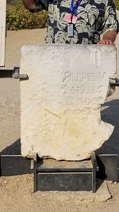 Now THIS is very important! For centuries, unbelievers have said that the Bible must not be true because there is not
historical information about Pontius Pilot. If Pilot was not real, then the Bible has falsities in it then it can't be trusted.
Now THIS is very important! For centuries, unbelievers have said that the Bible must not be true because there is not
historical information about Pontius Pilot. If Pilot was not real, then the Bible has falsities in it then it can't be trusted.
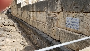
In 1961, archaeologists unearthed a limestone block in Caeserea with Pontius Pilot's name on it. This picture shows a "copy" of the stone. The original is in the Jerusalem museum. The ingraving on the stone says "Pontius Pilot, the prefect of Judea, erected a building dedicated to emperor Tiberius"
As always, archaeology proves the Bible!
 As mentioned, Caeserea was the main city of the Romans, and the city where goods flowed in. And of course, the Romans
taxed the goods. Here are storage bins where goods coming in by ship would be stored until taxes were paid. The ruins
in the foreground are what remains of the adminitrative offices where the taxes were charged. The port was directly
behind the camera, where the ships would have been docked.
As mentioned, Caeserea was the main city of the Romans, and the city where goods flowed in. And of course, the Romans
taxed the goods. Here are storage bins where goods coming in by ship would be stored until taxes were paid. The ruins
in the foreground are what remains of the adminitrative offices where the taxes were charged. The port was directly
behind the camera, where the ships would have been docked.
 Now this is an interesting picture, although at first glance, you might not think so. Look out at the ocean and you
will see ruins going across from left to right on the left and right to left on the right. These are what's left of
the breakwater of the port. But what is amazing is that this is construction that the Romans built to CREATE the port!
Now this is an interesting picture, although at first glance, you might not think so. Look out at the ocean and you
will see ruins going across from left to right on the left and right to left on the right. These are what's left of
the breakwater of the port. But what is amazing is that this is construction that the Romans built to CREATE the port!
The ocean floor is 70 or something feet down. How could they do this? Turns out that Harrod the Great has been credited with discovering cement that drys in water! Amazing for back then! Part of the fomula was limestone from Mount Vesuvius! (the mountain didn't blow up and destroy Pompeii until 100 years after this port was built).
Using swimmers/divers, they were able to put cement on bricks and swim down and place them, one at a time, until the harbor breakwater was created. Am amazing feet of engineering!
The ruins out in the water are what's left of the harbor breakwater retaining wall today.
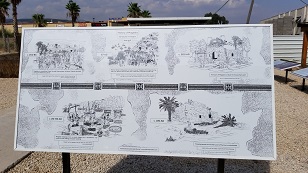
 This picture is a placard at the Caeseria port ruins that show how the port would have looked during Herod's time,
following construction. And of course, it would have looked this way in Jesus' time and when Paul, Peter, and others
were here.
This picture is a placard at the Caeseria port ruins that show how the port would have looked during Herod's time,
following construction. And of course, it would have looked this way in Jesus' time and when Paul, Peter, and others
were here.
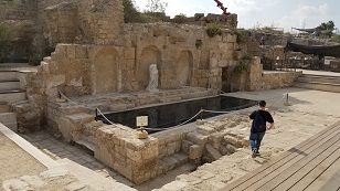 Every Roman city of any size had to have a water source. Typically, the water was brought in by dikes if the water was
nearby or by aqueducts if not. Aqueducts brought water from the mountains to Caesera and deposited it here, in the central water area of the city. People would come here with buckets, pails, etc., to collect the water for home/business areas.
Every Roman city of any size had to have a water source. Typically, the water was brought in by dikes if the water was
nearby or by aqueducts if not. Aqueducts brought water from the mountains to Caesera and deposited it here, in the central water area of the city. People would come here with buckets, pails, etc., to collect the water for home/business areas.
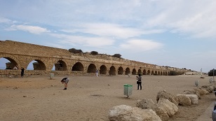 Here are the remains of the Roman aqueduct that brought water from "the springs of Shummi", in a mountain area 10KM away.
What makes these amazing is that, for the water to flow, it had to flow downhill, using gravity, since pumps didn't
exist in Roman times.
Here are the remains of the Roman aqueduct that brought water from "the springs of Shummi", in a mountain area 10KM away.
What makes these amazing is that, for the water to flow, it had to flow downhill, using gravity, since pumps didn't
exist in Roman times.
So, to make a downhill run for 10KM, the slope was millimeters at a time, and only inches from start to finish. This is an amazing feet for the time period, requiring micro measurement abiliies when handling heavy, uneven rocks!
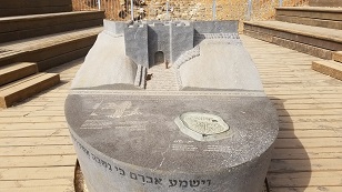
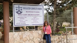 We are now at Dir El-Muhraka, or "Horn of Carmel Monastery". This Monastery is a Catholic church on the Mount of Carmel. It commemorates, and it is believed that the Monastery is near, the place where Elijah battled the prophets of Baal as described in 1 Kings 18:38-40.
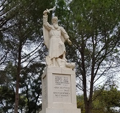 Here we have a statue of Elijah that commemorates the place and what happened here, when Elijah battled the prophets of Baal.
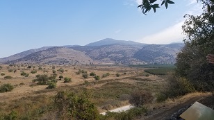
 Here we have a view of the Jezeel valley; the Valley of Armageddon, as seen from the Dir El-Muhraka Monastery, where
Elijah battled the prophets of Baal in 1 Kings 18:38-40.
Here we have a view of the Jezeel valley; the Valley of Armageddon, as seen from the Dir El-Muhraka Monastery, where
Elijah battled the prophets of Baal in 1 Kings 18:38-40.
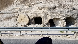 Now in this picture we see along the road, a great example of how burial places were during the time of Jesus. The hole in the side of the rock wall was carved out as a burial place.
Now the covering of the entryway of the tomb was a stone wheel, as you can see in this picture. The wheel would be rolled in front of tomb entry to close the tomb. Later, the stone could be rolled back to expose the entry way to add people
as the family that owned the tomb had further deaths.
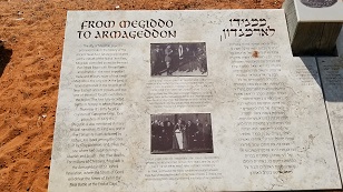 We now arrive at Mediggo. Mediggo is a set of ruins on the west side of the the Jezreel Valley, OKA The Valley of Armageddon. Mediggo was an important, strategic city in Old Testimate times. Roads from the north (Syria area) and from the south, Israel, Saudia Arabia, etc, met here. So this area was a very strategic location and a natural place for a city for trade, defense, etc.
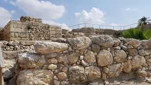 Here is a picture of one of the entry "gates" at the ruins of Mediggo (ruins are in the back). Gates were city entryways where principals of the city would sit, administrate, be visible, welcome visitors, etc.
 Here Adelina poses in front of the ruins of the old city of Mediggo, on the west side of the Valley of Armageddon. A portion of the valley is in the background, to the left of Adelina.
 During King Solomon's time, the King had a number of city's in Israel designated as Chariot Cities. These were locations where he would place garrisons of horses and chariot's. Mediggo was one of those cities. The picture here is the location of the horse stables in Mediggo, and the metal horse and chariot display here denotes that.
In ancient times, horses and chariots were the equivilent of tanks in today's mechanised armies. So you can see that it made sense to have "tank" garrisons strategically placed, so as to get to battle areas quickly, if needed.
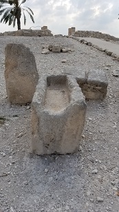 This picture shows a "manger". In Biblical times, a manger was a stone trough that held food or liquid used to feed animals. Here, at the horse stable ruins at Mediggo, a manger was found and is on display.
So you can see that for the baby Jesus to be laid in a "manger" when he was born, meant that he was laid in an animal feeding trough. Of course, with blanks and padding, it probably made a good crib.
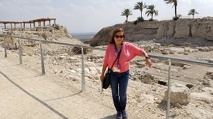
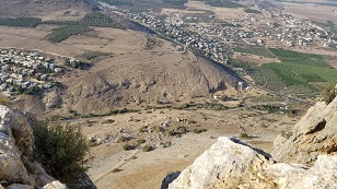
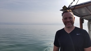
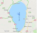
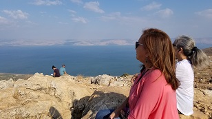 Once we left Megiddo, our wonderful tour traveled to Mount Arbel. Here is have an absolute spectacular view of the Sea of Galilee (which is really a big lake), and the surrouding area.
We have time for a devotional and time for contemplation at this fantastic location. Here Adelina and our traveling companion, Mimi, take some quiet time for reflection in the lovely, inspirational, location.
 This picture does not look interesting, but it's actually VERY interesting. We are looking down the north face of mount Arbel, near the spot where we had our devotional and spectacular view of the Sea of Galilee. The path in the foreground cuts through the mountain range that Mount Arbel is a part of.
What makes this interesting is that Nazareth (village Jesus lived in) was west of here. To the right, is the sea of Galilee, where Jesus' northern ministry was, in towns such as Capernaum. So Jesus would have HAD to walk this path at the base of the Mount Arbel here!
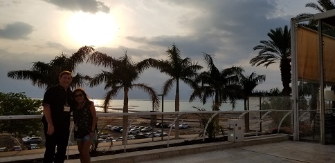
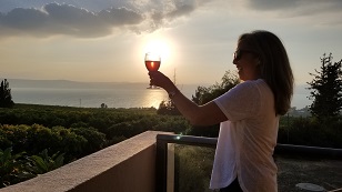 After our first full day touring the great Holy Land, we arrive at our hotel on the east side of the Sea of Galilee, the Ramot Resort Hotel. A very nice hotel with a fantastic view of the Sea of Galilee on the west and the sunet beyond it.
Mimi toasts the country and the view with the sunset, shining through a glass of Cabernet.
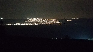 A night view from our hotel on the Sea of Galilee. Here we see the city of Tiberias, on the west side of the Sea of Galilee, which is in the foreground.
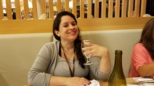 All of our group, except one person, were people that registered with our church group. There was one exception, Katie, who we are enjoying a dinner with. Katie is from a church in San Diego and signed up to tour the Holy Land on her own. The tour agency assigned her to our group and we were blessed to have her with us!
 On our second day touring the Holy Land, we were blessed to be able to take a boat ride across the Sea of Galilee! Here Bill and Adelina get settled to enjoy the boat ride near the pier where we depart, on the north east side of the Sea.
 On our boat with the beautiful view of the lake, is our Senor Pastor of our church, Tony Wood. It was a speical blessing to be able to share the holyland with our wonderful Pastor.
 Here we have a Goggle Maps GPS pic while we're in the middle of the Sea of Galilee. Yes, we were there!
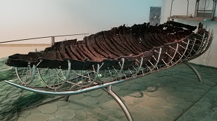 After our boat ride, we arrive Yigal Alon Hostel. This hostel has possession of a boat that was found in the mud near the west shore of the Sea of Galilee. Called the Ancient Galilee Boat, it is a boat from the time period of Jesus, and is believed to be of the kind that fisherman (such as Peter) used during Jesus' time.
Of course, there is no reason to believe that Jesus ever rode in this particular boat... but you never know..
 From the hostel museum where we saw the Gailiee boat, we go north and then east, around the top of the Sea of Galilee, and visit the ruins of Capernaum. Capernaum was Jesus' home base for his public ministry in the Sea of Galilee area. So Jesus walked this area frequently!
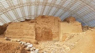
 This picture in Capernaum, is the side foundation of the ruins of the Synagogue of the city. Now the ruins themselves are from the 2nd-3rd century. But.. if you look closely at the picture, you can see the dark foundation stones of this Synagogue, below the lighter ones. These dark stones are from an EARLIER Synagogue from the time of Christ.
Basically, Jesus HAD to walk and preach in the Synagogue in Capernaum often, since he lived there on and off during is public ministry. And these black foundation stones ARE from that Synagogue. So, Jesus walked on this foundation! Amazing!
 Now, in addition to Capernaum being the home base of Jesus during his public ministry, Capernaum was the village that Peter lived, according to the scripture. During archaeological digs, they have found the ruins of a home. Carved on the inside was a note that this was Peter's house.
Being that people from the time that these ruins were in use would have likely known for sure, and the ruins are from the right place and time.. it is generally felt that this WAS the ruins of Peters house. What a blessing to be here and see and walk on the places that Jesus and Peter - and no doubt the other Apostles - walked and lived!
Note that the structure on top of the ruins is a meeting place and gift shop, etc., of the perprioriers of the archaeological/museum area.
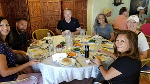 After our great visit to Capernaum, we stop for lunch at a lovely local place, and eat local cuisine. Great lunch!
Our friends, left to right: Cindy, Chris, Tony, Mimi, Anna, Adelina. And Bill behind the camera.
 Following lunch, we visit Magdala, or Magdelina. This then, is the village where Mary Magdalene came from! We don't know where she lived in the village, but we can enjoy and for a brief moment, imagine what life must have been like for her and the folks in the city.
Magdala was predominantly a fisher and boat building village, with the location being right on the Sea of Galilee water at the time of Mary.
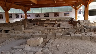 Here are the ruins of the Synagague from Jesus' time at the village of Magdala. Now, this area is in the area that Jesus walked, talked, and taught during this public ministry when in the north part of Israel. Also, Mary Magdalene was a key person in Jesus' inner circle and it would be unreasonable not to believe that, when in this area, Mary, and also Jesus occassionally, visited this village. And if in the village, Jesus would have taught in the Synagague.
So, while we don't have any scripture references for it, Jesus must have been in this place on occassion. What a blessing to be here too.
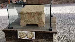 If you look at the picture above, of the ruins of the Synagague at Magdala, in the back middle of the runs, you will see a stone block just like the one in front of this picture. Both of these blocks, the one in the case, and the one in the Synagague ruins itself, are copies. The original one found has been moved to a museum.
The interesting thing about this stone is that it holds a central place in the Synagague, but no one really knows it's purpose. It is thought that this stone was the place that the scrolls were laid during services and readings.
If Jesus was here, and it is almost a certainty he was, then he also used the stone block. Fantastic!
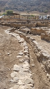 Interesting ruins in Magdala. A trough that brought water to the city from the Sea of Galilee. Always interesting ways the ancients come up with to get water to where they needed it. Of course, this was easier with the Sea of Galilee being so close then for a city of say, Caesera. But still interesting.
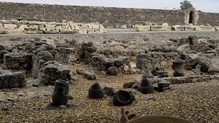
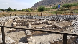 Ruins in Magdala where the average people lived. Each of these were homes that the common people of Magdala would have lived. No doubt Mary Magdelina was a "common" person, and probably would have lived in one of these homes.
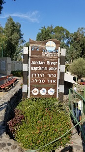 Leaving Magdala, we come to an area on the Jordan river which is the Yardenit Baptism Site. This area is run by a private Christian group, and provides a place for pilgrams to be baptised in the Joran river. The location also has a gift shop, changing rooms, rest rooms, etc.
Chuck Smith of Calvary Chapel in Costa Mesa had a big hand in seeking permission from the Israel government to build the baptism area, and providing funds for it's construction. What a blessing to be here and what a blessing for the people here that wanted to commit or re-commit, their lives to Christ!
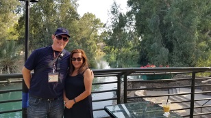 Adelina was baptised as an infant, and wanted to also be baptised as an adult in the Jordan. What a blessing!
What a wonderful time! Adelina has chosen to be baptised in the Jordan river, to publically pronounce her faith. Adelina wanted Pastor Tony to perform the baptism and it was great that he could do it.
What a wonderful experience for Adelina and for her family! God is great and this experience, in this place, was the capstone of our trip and provided a personal blessing that will be hard to top. Thank you Tony. Thank you Lord!
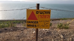 Now here is something you don't see everday (at least in the U.S.). A sign telling you to be careful of land mines.
As we leave the jordan river baptism location, we head north east to the Golan Heights. "The Golan" is disputed area
between Syria and Israel, and the area has lookouts and heightened security. As we move through the area, we find area's on along the road, which are mined to keep instrustions out or at least, minimized.
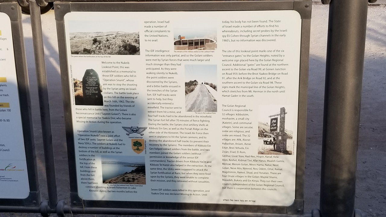 There was a lot of action in this area of the minefield, during the six-day war. This area also commorates a battle and Israel losses holding this area and a major offensive at the time, Operation Snunit.
 At the most northern location in Israel is "Tel Dan". Dan was the captial of Israel in Biblical times when the nation split into Northern Israel and Southern Judia.
Here we see a river that is one of the main tributaries that make up the Jordan River, running south into Israel.
 Dan, the main city in Northern Israel, when the country broke into two parts in Biblical times, was idolatrous. They made sacrifices of enemies and also of their children, on the alter in Dan, the Bible records.
Here is that alter! In the ruins of Dan, this big alter is clearly the place. So much suffering and evil these stones have seen.
 So here we are in the ruins of Dan, the most northern part of Israel - both now and in ancient Biblical times. So, what then is north of Israel? Lebanon.
Here we have a view north of Israel. The Israeli border with Lebanon is in the far foreground, and the hills at the back of the picture is Lebanon territory.
 These ruins are to the east of the main Dan alter area. This is an old ancient Cannanite Gate (entryway to a city).
Called the Gate of Three Arches. This was the main enterance to this city and the time of Abraham. It is recorded
in the Bible that Abraham went to this city. So he had to walk through this gate! amazing!
These ruins are to the east of the main Dan alter area. This is an old ancient Cannanite Gate (entryway to a city).
Called the Gate of Three Arches. This was the main enterance to this city and the time of Abraham. It is recorded
in the Bible that Abraham went to this city. So he had to walk through this gate! amazing!
 Here is a small model in the area of the Cannanite Gate, that shows how the gate (city entrance) would have looked
to Abraham, in his time.
Here is a small model in the area of the Cannanite Gate, that shows how the gate (city entrance) would have looked
to Abraham, in his time.
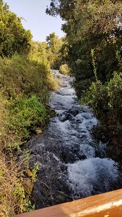
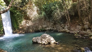 After leaving Tel Dan, we stop by a beautiful tourist and local spot that feeds the Jordan River, and has a wonderful
water fall, lot's of vegatation, and is very peaceful.
After leaving Tel Dan, we stop by a beautiful tourist and local spot that feeds the Jordan River, and has a wonderful
water fall, lot's of vegatation, and is very peaceful.
This area is called the Hermon Stream. The water is fed from Mount Hermon. A very beautful area.
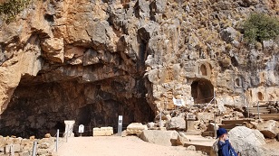 We now arrive at an ancient city in north east Israel, Caeseria Philipi. This was a very big and active Roman city
during Jesus' (and thus Roman) times. It is on the base of the Golan Heights and Mount Hermon. The city was
originally name Paneas. It was later named Caeseria to pay tribute to Caeser, and Philippi (Greek for Philip,
the name of the founder of Paneas), to distinquish it from the city of Caeseria near the coast (see pictures earlier,
where we visited Caeseria).
We now arrive at an ancient city in north east Israel, Caeseria Philipi. This was a very big and active Roman city
during Jesus' (and thus Roman) times. It is on the base of the Golan Heights and Mount Hermon. The city was
originally name Paneas. It was later named Caeseria to pay tribute to Caeser, and Philippi (Greek for Philip,
the name of the founder of Paneas), to distinquish it from the city of Caeseria near the coast (see pictures earlier,
where we visited Caeseria).
Here is picture of the main worship area in the city, where Roman peagan statues were located (in the big and little
holes in the side of the mountain) and sacrifices were done at various time periods. Mostly to the Roman god Pan.
It was in this area where Jesus and Peter had the conversation where Jesus asked Peter who people said that he (Jesus) was? Peter answered that Jesus was the Christ, the Son of the living God.
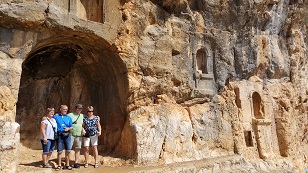 Here is a picture of some tourists (these folks are not part of our tourist party), at the mouth of the cave. Some of the additional holes carved in the mountain, where statues of Roman gods were displayed, can be seen on the right.
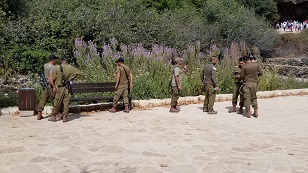 Here we are in the Caeseria Phlippi tourist area and we see local military. Always good to see them.
However, our tourist guide tells us these guys are part of a special military unit. These gents are Arab/Israeli
citizens that have volunteered for the Israeli army. God bless them!
 Now our tour bus goes up to the top of the Golan Heights, near the Syrian border. There are many lookout outposts
in this area that watch the Syrian border. One lookout post has now been turned into a tourist area, so tourists
can see Syria and the tatical situation on the Golan.
Now our tour bus goes up to the top of the Golan Heights, near the Syrian border. There are many lookout outposts
in this area that watch the Syrian border. One lookout post has now been turned into a tourist area, so tourists
can see Syria and the tatical situation on the Golan.
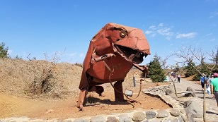
As we approach this former outpost, we see a number of Israeli artists creating monsters and animals out of metal and
display them along the road. Here is looks like an overfed tyrannosaurus rex.
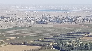 From out lookout post on the Golan, where military observers used to watch the Syrian border (and many still do, to the
right and left of us at other lookout posts), we see the Syrian border in the distance. There are Israeli settlements near the border, as you can see in the foreground of this picture. They would likely be overrun if hostilities started, but the land is furtile and farming, as you can see, is productive.
From out lookout post on the Golan, where military observers used to watch the Syrian border (and many still do, to the
right and left of us at other lookout posts), we see the Syrian border in the distance. There are Israeli settlements near the border, as you can see in the foreground of this picture. They would likely be overrun if hostilities started, but the land is furtile and farming, as you can see, is productive.
In the distance, past the foreground settlement, you can see what almost is a line going from left to right. This is
the Israeli/Syrian border. Beyond, in the distance, is another settlement, which is in Syrian territory. You can
see how strategic the Golan is and vital that Israel keep it.
Not pictured, but on the other side of the Golan, behind the camera, is northern Israel. The Golan is a big mountain area, and he that controls it, can easly lob artillery down on northern Israel, and basically, control that area.
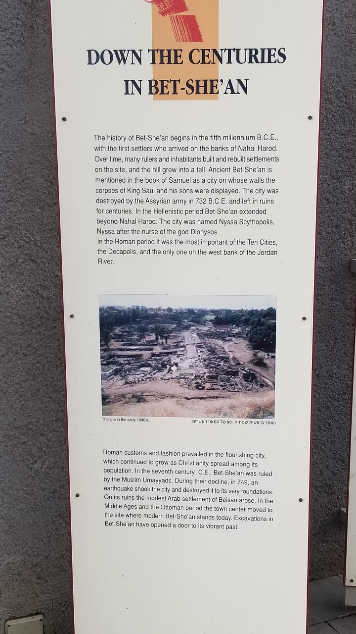 We stop in the ruins of the ancient city of Bet-She'an. This city existed all the way back in the Old Testament.
Israels' first king, Saul, was not God's selection for King, but was picked by the people. He didn't follow God's
laws and God told Saul, via a Medium at the city of Endor, that Saul would die in battle the next day; which he did.
The Philistines, who won the battle, nailed his body to Bet-She'ans gate to let everyone know they conquered the
governemnt of the Israelites.
We stop in the ruins of the ancient city of Bet-She'an. This city existed all the way back in the Old Testament.
Israels' first king, Saul, was not God's selection for King, but was picked by the people. He didn't follow God's
laws and God told Saul, via a Medium at the city of Endor, that Saul would die in battle the next day; which he did.
The Philistines, who won the battle, nailed his body to Bet-She'ans gate to let everyone know they conquered the
governemnt of the Israelites.
During the Roman invastion of Israel, Bet-She'an became a big Roman city. It was one of the 10 cities in Israel,
known as the Decapolis (meaning 10 cities). During Roman times, the city was known as Nyssa Scythopolis.
 The Roman ruins of the amphitheater at Bet-She'an, AKA Nyssa Scythopolis
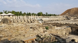 A view of the ruins of the main street and marketplace area of Nyssa Sycthopolis, which was also known as Bet-She'an
in the Old Testament.
A view of the ruins of the main street and marketplace area of Nyssa Sycthopolis, which was also known as Bet-She'an
in the Old Testament.
You can see the columns that lined both sides of the street. There would most probably have
been a covering of wood or similar between the columns to provide protection from the sun and rain.
 Now this is an interesting picture and place. There were no indoor plumbing in Roman cities, except perhaps a local
king or other "muck-e-muck". Big cities HAD to have some sort of way to handle sewage, or disease will happen; which
is what happened in the middle ages in Europe. But Rome didn't have this problem because they handle the situation.
Now this is an interesting picture and place. There were no indoor plumbing in Roman cities, except perhaps a local
king or other "muck-e-muck". Big cities HAD to have some sort of way to handle sewage, or disease will happen; which
is what happened in the middle ages in Europe. But Rome didn't have this problem because they handle the situation.
Here is the way. Public bathrooms, with no privacy, and unisex.
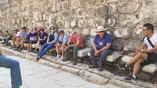
Our intrepid tour group is sitting on stones that come out of the wall. The stones are close together so that you can sit
between them. And with your pants down, you can relieve yourself. No urnals, so it appears men sat.. although perhaps they didn't. No documentation that we're aware of one way or the other, so we don't know. But with the apparent lack of privacy of these Roman toilet facilities, it's a sure bet everyone at the time knew.
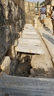 This is a side view of the seats and toilet setup of the ancient Roman public bathrooms (see above picture). You can
see the trench at the bottom, where city water flowed through. So waste deposited was flowed out, into underground
pipes. The waste water had to ultimately end up in the Jordan River, making downstream not much fun.
This is a side view of the seats and toilet setup of the ancient Roman public bathrooms (see above picture). You can
see the trench at the bottom, where city water flowed through. So waste deposited was flowed out, into underground
pipes. The waste water had to ultimately end up in the Jordan River, making downstream not much fun.
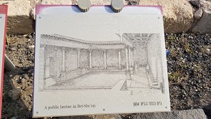 A picture of what the Nyssa Scythopolis (Bet-She'an) public latrines looked like during operation in Roman times.
This public latrine was near the city Amphitheatre. So when something was going on, I'm sure this place was much
busier than depicted in this drawing.
A picture of what the Nyssa Scythopolis (Bet-She'an) public latrines looked like during operation in Roman times.
This public latrine was near the city Amphitheatre. So when something was going on, I'm sure this place was much
busier than depicted in this drawing.
 Here is a view of the main street and marketplace in Nyssa Scythopolis (Bet-She'an). Note the bump in the middle of
the road. The sewage line of the city ran under this spot.
Here is a view of the main street and marketplace in Nyssa Scythopolis (Bet-She'an). Note the bump in the middle of
the road. The sewage line of the city ran under this spot.
 Our intrepid tour group arrives at a very beautiful kept public park in southern Israel. This is the site of the Harod
spring, a tributary water supply that ultimately drains into the Jordan.
Our intrepid tour group arrives at a very beautiful kept public park in southern Israel. This is the site of the Harod
spring, a tributary water supply that ultimately drains into the Jordan.
This is the place with Gideon selected, with God's help, the 300 men to fight the much greater number Medianites
as the Bible mentions in Judges 7:16-17.
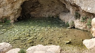 A cave where the waters of the Harod spring exit the local mountains. This cave is called Gideon's cave, because
it was here and the stream behind the camera, where Gideon selected his men to fight the Medianites.
A cave where the waters of the Harod spring exit the local mountains. This cave is called Gideon's cave, because
it was here and the stream behind the camera, where Gideon selected his men to fight the Medianites.
Humbling to think that a Godly man, Gideon, so long ago, saw this same cave, and was in this same place!
Note that the water here is so clear, it looks in the picture like only rocks exit the cave, but there is a few feet
of water flowing out from the cave here. It's just so clean, you can't tell from the pic.
 Here, our intrepid group leader, Gene, demostrates what Gideon's solders did that qualified them to be in the group
of men that attacked the Medianites. And our favorite Pastor, Tony, is behind him, demonstrating what the solders did
that disqualified them.
Here, our intrepid group leader, Gene, demostrates what Gideon's solders did that qualified them to be in the group
of men that attacked the Medianites. And our favorite Pastor, Tony, is behind him, demonstrating what the solders did
that disqualified them.
Those that cupped the water in their hands and drank that way were in. Those that lapped the water in the stream itself were out.
 As we proceed along the main road from northeast Israel to southeast Israel, to get to the dead sea, it is necessary
to pass through the west bank, which is occupied by the Arabs, and which Israel citizens are not allowed. But Israel
maintains control of the main road though this area. Otherwise, Israel citizens would have to travel a very long way
to go around the west bank to get to southern Israel from the east side of the country.
As we proceed along the main road from northeast Israel to southeast Israel, to get to the dead sea, it is necessary
to pass through the west bank, which is occupied by the Arabs, and which Israel citizens are not allowed. But Israel
maintains control of the main road though this area. Otherwise, Israel citizens would have to travel a very long way
to go around the west bank to get to southern Israel from the east side of the country.
Here, we stop at a small rest stop area along the road, surrounded by the Arab west bank on both sides. You can see
the security fence in the foreground. Behind the fence is west bank/Arab territory.
 We arrive during our travels to a wonderful restort hotel on the south side of the dead sea. Very popular with locals
and tourists alike. Enjoy the pool, dead sea, and other amenities.
We arrive during our travels to a wonderful restort hotel on the south side of the dead sea. Very popular with locals
and tourists alike. Enjoy the pool, dead sea, and other amenities.
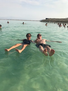
Here Bill & Adelina relax in the dead sea. With all the salt, it is impossible to sink. Everyone just floats. But
dont' get the water in your eyes! Burn-mania!
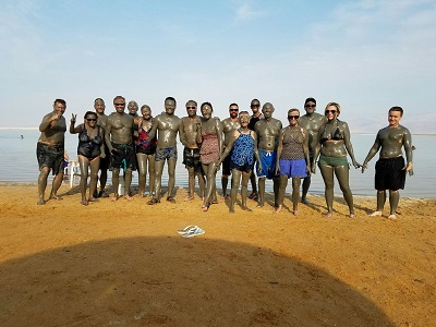 What in the world? Why, it's our intrepid tour group, getting an invigorating mud bath at the dead sea, thanks to
our tour group leader that arranged all the mud. A fun - and dirty - time! Thank you Morningstar Tours!
What in the world? Why, it's our intrepid tour group, getting an invigorating mud bath at the dead sea, thanks to
our tour group leader that arranged all the mud. A fun - and dirty - time! Thank you Morningstar Tours!
The mud smooths the skin and is supposed to be very therapeutic. Adelina says that her bug bites stopped itching
and appeared to be on-the-heal, followng the mud.
 After our adventures in the dead sea, we relax in the evening and take in the view. These resort areas are popular with locals and tourists alike. Enjoy the pool, dead sea, and other amenities. We spend a respite of an afternoon and evening at the resort before we move on with our wonderful tour of the Holy Land.
 As we depart the south side of the dead sea, we take the highway going north toward Jersusalem, along the western
edge of the dead sea. There is a rock formation called Lot's Wife here and we stop.
As we depart the south side of the dead sea, we take the highway going north toward Jersusalem, along the western
edge of the dead sea. There is a rock formation called Lot's Wife here and we stop.
As you may recall from Genesis, the Angels of the Lord evacuated Lot and his family just prior to passing judgement
on Sodom and Gomorrah, settlements whose ruins archeologists believe they have found on the east side of the dead sea.
The Angels told Lot and his family to run and to not look behind them at the destruction of Sodom (where they lived), as
they were being evaculated. Lot's wife, according to scripture, did look back and was turned into a pillar of salt.
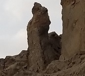
This rock salt formation looks a lot like a person and is looking in the direction of Sodom. Who knows..
 Here is Adelina and Lot's wife. One is interesting... one is beautiful..
 We have arrived at the ruins of the mountain fortress of Masada. Masada is not mentioned in the Bible and Jesus was
never here. But it is a monument of the times back then and a powerful reminder to the Israelies. Israel's military
motto is: "Masada will never fall again!"
We have arrived at the ruins of the mountain fortress of Masada. Masada is not mentioned in the Bible and Jesus was
never here. But it is a monument of the times back then and a powerful reminder to the Israelies. Israel's military
motto is: "Masada will never fall again!"
What happened here is that, when the Romans invaded Israel in 70 A.D., a group of Israeli defenders took
refuge at the top of the Masada mountain. Herod the Great had built a fortress and palace on Masada, complete with water collection mechansims when it rained, areas to grow food, shelter with the buildings there, and a defensible position, with only one small road up/down the mountain.
Rome wanted these "zealots" as examples and spent 5 years sieging the mountain!. The Roman army ultimately succeeded
in getting to the top of the moutain by buiding a 2000 foot ramp via Jewish slaves, that the Zealots would not arrow and
throw rocks to kill. The 960 zealots and their familiies on top of the mountain all committed suicide the night before the Roman army broke though to the top!
Here is take the trip to the mountain via a cable cars to see this solemn place.
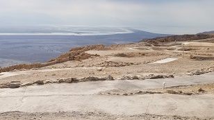 A view of the dead sea in the distance from Masada. How many times was this same view taken in by the 960 people
held on this mountain by the Roman army during the five year siege of Masda in 70 A.D.
A view of the dead sea in the distance from Masada. How many times was this same view taken in by the 960 people
held on this mountain by the Roman army during the five year siege of Masda in 70 A.D.
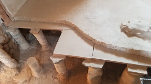
 Here we see on room in King Herod's castle. He build the fortress on top of Masada for the very reason that the Zealot's
hid there. To live comfortably while hiding and defending against anyone trying to attack and/or kill you.
Here we see on room in King Herod's castle. He build the fortress on top of Masada for the very reason that the Zealot's
hid there. To live comfortably while hiding and defending against anyone trying to attack and/or kill you.
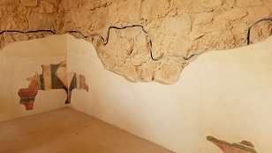
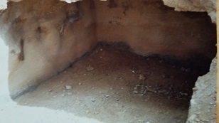
Here is a portion of the top, plaster like coating over the rock walls, that made the palace a beautful place for Kings.
On top of the plaster, would be paintings and drawings. A paint facade can be seen over the plaster in the corner,
in this frame.
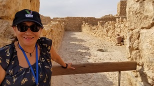 Adelina posing in front of one of many large storage rooms in the Masada complex. These were intended to be used for
storage of food, wine, etc. (water was stored in cisterns carved out of the side of the mountain).
Adelina posing in front of one of many large storage rooms in the Masada complex. These were intended to be used for
storage of food, wine, etc. (water was stored in cisterns carved out of the side of the mountain).
I'm sure that, during the Roman siege of the Jewish Zealots in 70 A.D., some of the storage areas were used for sleeping and living quarters. Masada was not built for 960 people, including families, on the mountain.
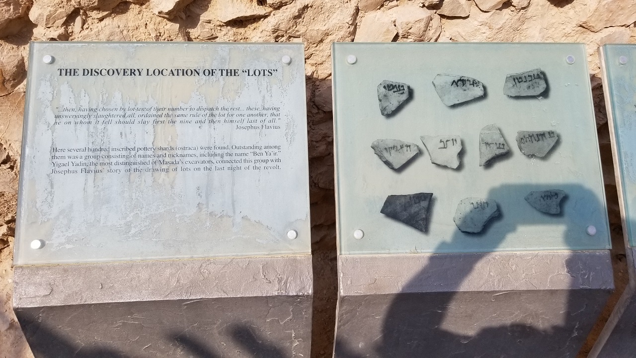 Here is an amazing archaeological discovery! The Jewish people on top of Masada, when they knew that the Roman army
would breech the defenses the next morning and attack and capture the Zealot's, chose suicide to prevent capture,
slavery, torture, and death.
Here is an amazing archaeological discovery! The Jewish people on top of Masada, when they knew that the Roman army
would breech the defenses the next morning and attack and capture the Zealot's, chose suicide to prevent capture,
slavery, torture, and death.
The process was that each man would kill his family. Then 10 men were chosen, via lots, to kill the other men. Then
one man via lots, to kill the other 9 men. Then the remaining man would fall on his sword and kill himself. This was
because suicide was against God's law, so only the man that the lot fell on would have to actually kill himself.
The lot's that were used were found and are on display here! Amazing!!
 Since Herod the Great build a palace on Masada mountain, it stands to reason that he'd want all the comforts that his
kingly home that his Jerusalem home had. That would include a bath house for relaxing and bathing.
Since Herod the Great build a palace on Masada mountain, it stands to reason that he'd want all the comforts that his
kingly home that his Jerusalem home had. That would include a bath house for relaxing and bathing.
Don't forget, the Romans didn't takes baths or showers. They didn't even have soap. They spread oil on their skin and then scraped it off at bath houses to clean themselves.
Here we see the floor and sub-floor of Herod's palace spa/bath house. Heat and steam for an adjacent room would move
into the sub-floor via pipes and heat the spa/bath floor. Small holds in the walls would allow steam to come into the
room also.
 There is a picture of one of the cisterns; big holes carved out in the side of the rock at Masada. Grooves in various
places in the mountain routed rain water to these series of cisterns and thus, provided clean water for drinking,
bathing, etc.
There is a picture of one of the cisterns; big holes carved out in the side of the rock at Masada. Grooves in various
places in the mountain routed rain water to these series of cisterns and thus, provided clean water for drinking,
bathing, etc.
Not a lot of water falls in this area, but enough to support 1000 people on this mountain, as was the
case of the Jewish Zealots that lived here during the siege.
Too bad we don't do this in the U.S. Gallons upon gallons of rain water wash to the sea in U.S. cities near the
coast, such as Los Angeles, where we really need the water.
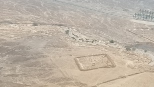 Now here is an interesting view. As mentioned above, the Roman army sieged Masada for five years. They had camps
all around the mountain so the Jewish people on top could not sneak out. I'm sure much of these camps were tents or
the army slept on the ground. But some stone strucures were built at the army camps.
Now here is an interesting view. As mentioned above, the Roman army sieged Masada for five years. They had camps
all around the mountain so the Jewish people on top could not sneak out. I'm sure much of these camps were tents or
the army slept on the ground. But some stone strucures were built at the army camps.
This picture is a view from the top of Masada looking to the ground at the base of the mountain. We see the ruins of
one of the Roman army camps that surrounded the mountain.
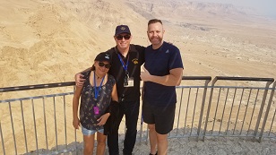 A nice picture of Pastor Tony, with Adelina and Bill. Hard to tell from the picture, but the Roman army captured
Masada by building a 2000 foot ramp from the ground, up to the top of Masada for the troops to come up (protected
by siege weapons and ramparts).
A nice picture of Pastor Tony, with Adelina and Bill. Hard to tell from the picture, but the Roman army captured
Masada by building a 2000 foot ramp from the ground, up to the top of Masada for the troops to come up (protected
by siege weapons and ramparts).
The area in the background is part of that ramp.
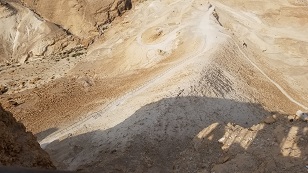 Here you can see the remains of the ramp that the Romans build, on the backs of Jewish slaves, to ultimately reach
the top of the Masada mountain and attack to Jewish Zealots holding on the mountain.
Here you can see the remains of the ramp that the Romans build, on the backs of Jewish slaves, to ultimately reach
the top of the Masada mountain and attack to Jewish Zealots holding on the mountain.
The Jews at the top of the mountain would not rain down rocks and arrows on their countrymen, and so it was possible for
the ramp to be built.
The Romans build siege weapons, large wood structures with wheels, that protected the troops as they moved up the ramp. A battering ram, flaming arrows, and Roman archers on the siege weapon were able to counter Jewish attempts to push them
back and thus, to breech the walls at this location on the mountain.
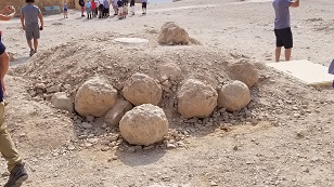 Remains of boulders created by the Jewish Zealot's for throwing and rolling down at the Roman army troops. These look heavy and I'm sure nasty, if you were to get hit with one.
I understand that, on average, 50% of Roman army troops died before their "time of service" was up. With these rocks and weapons like arrows, I can see why.
Not real clear in the picture, but the height of these rocks are about three feet.
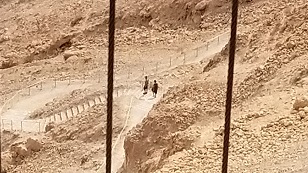 A few of the intrepid individuals of our party, chose to add to their Masada adventure, by walking down the mountain via
the path that the Jewish families took coming up and the Roman Army, on many occassions I'm sure, attempted to come up.
A few of the intrepid individuals of our party, chose to add to their Masada adventure, by walking down the mountain via
the path that the Jewish families took coming up and the Roman Army, on many occassions I'm sure, attempted to come up.
Here is peaceful and reflective picture of two of us, Chris and Cindy, walking down and reflecting. The rest of us meet
them at the bottom, via the more modern cable car.
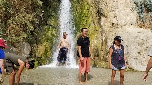 We depart Masada. Just an few hours there, but so much happened, so many years ago. Such tragedy. We arrive in a short
bus drive to Ein-Gedi. This is a very nice area, just past the desert area of the dead sea and Masada. In this area, water flows, trees flourish, and the temperature is cooler.
We depart Masada. Just an few hours there, but so much happened, so many years ago. Such tragedy. We arrive in a short
bus drive to Ein-Gedi. This is a very nice area, just past the desert area of the dead sea and Masada. In this area, water flows, trees flourish, and the temperature is cooler.
Ein-Gedi was the area, as mentioned in the book of Samuel, that David dwelled and hid out from King Saul, who was trying
to kill David, because David had been anointed by God to take the throne, and Saul didn't like that idea. David MUST have visited this specific area during his time here!
There are natural caves all over in the mountains around this area. Samuel records that David was hiding in one when
Saul when it to "relieve himself", and David spoke to him, showing Saul that David could have killed Saul if he had wanted
too. Saul didn't get the message though and continued to try to kill David until he himself was killed in battle later.
 Adelina getting refreshed at the waterfalls of Ein-Gedi, where David hid from Saul, as recored in the book of Samuel.
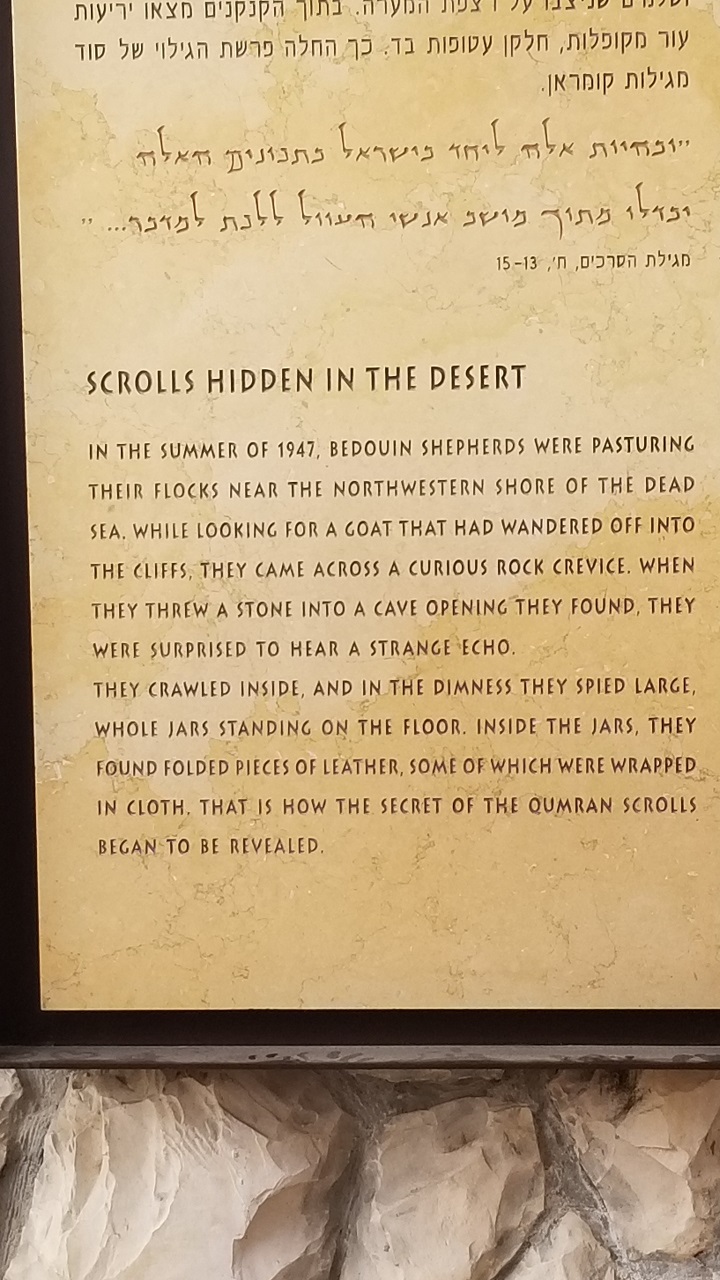 Departing Ein-Gidi, we arrive at an archelogical site on the north west of the dead sea; Qumran. Qumran is where
the Dead Sea Scrolls were discovered. The Dead Sea Scrolls was something that God had to keep until Israel became
a nation again, because in the ensuing years since they were stored, they would most likely have been distroyed if
they had been discovrered. Clearly God's hand was at work here.
Departing Ein-Gidi, we arrive at an archelogical site on the north west of the dead sea; Qumran. Qumran is where
the Dead Sea Scrolls were discovered. The Dead Sea Scrolls was something that God had to keep until Israel became
a nation again, because in the ensuing years since they were stored, they would most likely have been distroyed if
they had been discovrered. Clearly God's hand was at work here.
What the dead sea scrolls give us are two very important things. First is that the Old Testament that we have now IS
the same one that was being used prior and during the time of Jesus. Secondly, that the 300+ prophecies of Jesus in
the Old Testament WERE, in fact, real prophecies!
Some people say that the prophecies of Jesus in the Old Testament must have been written AFTER Jesus died, because they are so accurate. But the Dead Sea Scrolls were written 150-200 year BEFORE Christ. What a find and testimony to the inerrancy of scripture and the life of Jesus!
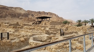 Here we see a picture, in the foreground, of some of the ruins at Qumran. Qumaran was the location where an ancient
group of strick Jews live for serveral hundred years before, and during, the time of Christ. They lived a life
not unlike how medieval Christan monks 1000 year later lived. They were very dilligent in copying and preserving the Old Testament, which we have today in our Bible.
Here we see a picture, in the foreground, of some of the ruins at Qumran. Qumaran was the location where an ancient
group of strick Jews live for serveral hundred years before, and during, the time of Christ. They lived a life
not unlike how medieval Christan monks 1000 year later lived. They were very dilligent in copying and preserving the Old Testament, which we have today in our Bible.
When the Romans, in 70 A.D., were raping, pillaging, and destroying Israel, the Essines knew the Roman Army was coming
and wanted to preserve the scrolls of the Old Testament and of their lives and the Essene governing rules, from being destroyed.
So they hid the many scrolls in clay jars in the many caves surrounding the Qumaran area. The Essenes were killed and scatterd by the Romans, but the Scrolls laid safely in the caves until Israel became a nation in 1948 and discovered them (via bedewan shephards).
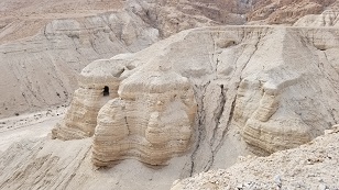 Here is a photo of the hills immediately to the west of the Qumran village, at the time of Christ. The cave in the
center of the photograph was the first, or one of the first, caves where dead sea scrolls were first discovered.
Here is a photo of the hills immediately to the west of the Qumran village, at the time of Christ. The cave in the
center of the photograph was the first, or one of the first, caves where dead sea scrolls were first discovered.
These caves are very close to the Qumran village.. 5 minutes as the crow flies, and probably 1/2 to 3/4 hour walking
distance by path. Amazing that the scrolls were never discovred until Israel became a nation. Unlikely they would have
been kept if they had been discovered. Very likely they would have been destroyed, since the area was occupied by
Arabs for most of the ensuing years between 70 A.D. and when Israel became a nation in 1948.
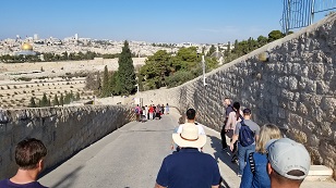 After our very interesting visit to Qumran, we travel to Jerusalem, the heart of our visit. We stay in a hotel for the
night and fresh in the morning we visit the Mount of Olives. What a blessing!
After our very interesting visit to Qumran, we travel to Jerusalem, the heart of our visit. We stay in a hotel for the
night and fresh in the morning we visit the Mount of Olives. What a blessing!
Now the Romans implemented a scorched earth policy when they sacked the city in 70 A.D., and the olive trees that were on this mountain during Jesus' time were, for the most part, destroyed by the Romans. The entire Israel area in subequent times was a desert, as the Bible predicted it would be, until the Jews occupied the land again. Olive trees grow again, but not to the extent they were during Jesus' time.
We travel down the road, from the mount of olives, toward the old city of Jerusalem and the temple mount area. The
road we travel on is a modern paved road, but along the same path as the old roads from this area into Jerusalem.
So there can be little doubt that Jesus walked this path 2000 years ago (albiet on dirt many feet below the current
road). How wonderful to walk this same path and see basically, the same things Jesus saw so long ago!
 So much to see here in this picture. We are at the base of the mount of olives, looking west toward the temple mount,
where the Jewish temple would have stood, during the time of Christ.
So much to see here in this picture. We are at the base of the mount of olives, looking west toward the temple mount,
where the Jewish temple would have stood, during the time of Christ.
The gold dome is the Dome of the Rock, where Islam believes Mohammad assended into heaven. The wall in the front is the
retaining wall, built by Herod the Great, to shore up the temple mount against the weight of the Jewish temple, that was
standing during Jesus' time. On the wall, 3/4 to the left, is what looks like an entry gate, but which is bricked up, so no one could enter. The Bible tells that Jesus will return and enter the Temple Mount thought this gate. So centuries ago, this gate was boarded up, so as to prevent the Christian God from fulfilling his mission (as if that would stop him)
In front of the wall is a valley, called the Kedron valley. Jesus walked to and from here to go between Jersusalem and
the mount of olives. Also, there are ancient tombs of people mentioned in the Bible here, such as Zechariah, who was
the father of John the Baptist.
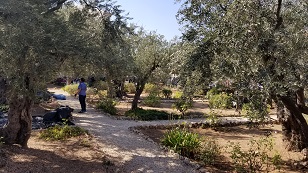 Here is a pic of some of the olive trees and area that are in the mount of olives today. Much smaller and with all
the tourists, much less peaceful than in Jesus' time. And yet, you can see how peaceful and quite it must have been
when Jesus walked this area. Tells you something of the quiet and peace that must exist in heaven.
Here is a pic of some of the olive trees and area that are in the mount of olives today. Much smaller and with all
the tourists, much less peaceful than in Jesus' time. And yet, you can see how peaceful and quite it must have been
when Jesus walked this area. Tells you something of the quiet and peace that must exist in heaven.
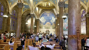 Here is a picture of the inside of the Church of All Nations. This church is a Catholic church and many feel the church rests on the spot where Jesus prayed to the Father and was arrested. No real evidence that this is the exact spot, but the spot where Jesus prayed and was arrested is certainly in this surrounding area somewhere. Was a privilage and a blessing to be here in any case!
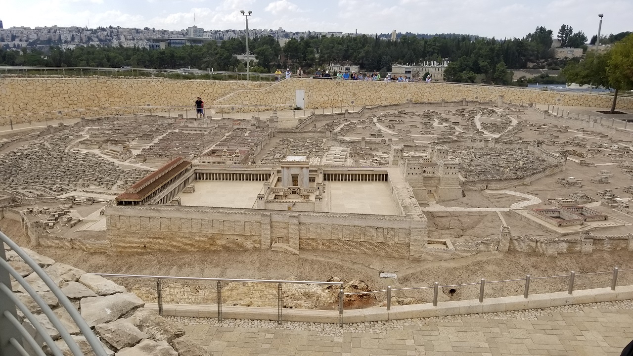 Here is another very important picture. It is a model of what the city of Jereusalem looked like just before it
was destroyed by the Roman army in 70 A.D. Wow!
Here is another very important picture. It is a model of what the city of Jereusalem looked like just before it
was destroyed by the Roman army in 70 A.D. Wow!
The temple mount is in the front center. The top right of the temple mount is the Antonio fortress (named after
Mark Antony), where the Roman garrison was quartered. In the back left, near where that person is standing, was
Herod's palace.
In the lower left of the temple mount, just to the left of the temple mount retaining wall, is the much smaller
area that comprised what is the city of Jerusalem during King David's time.
The pools of Bathesda are to the right of the lower left temple mount corner. Golgatha, where Jesus was crucified,
is on the other side of the Anotonia fortress from this view.
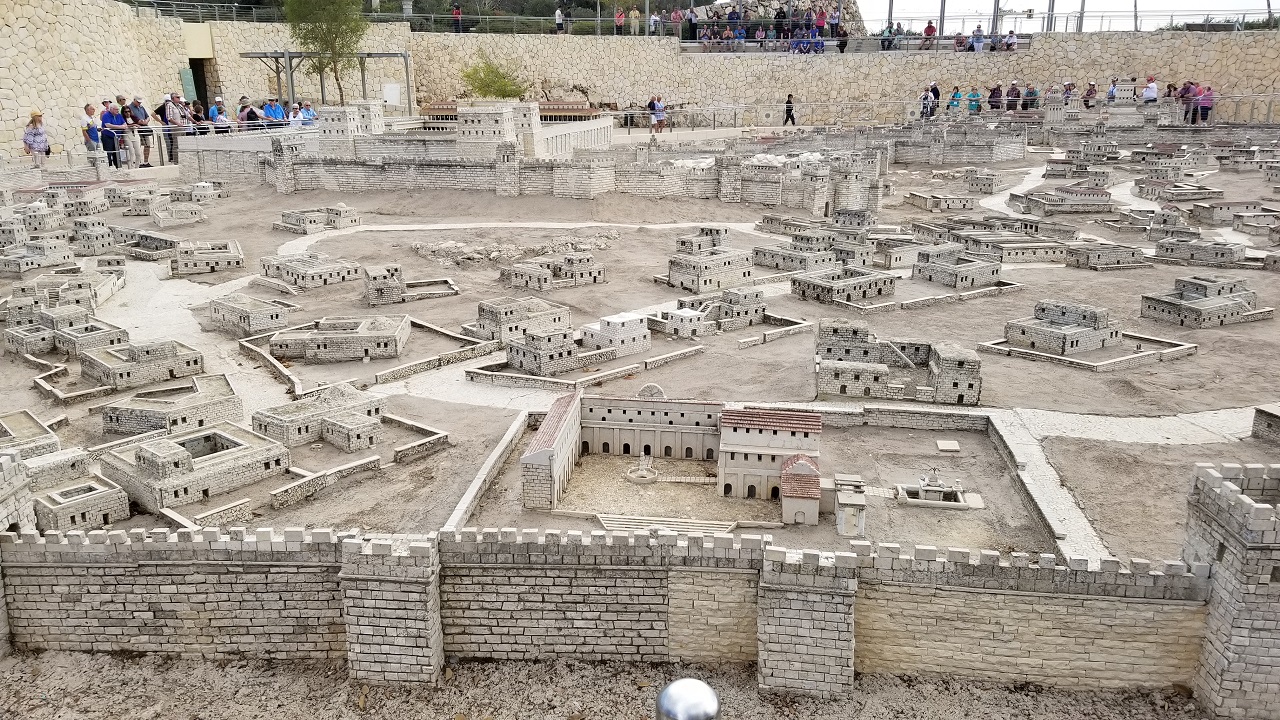 A view of the model of Jersualem during and immediately after, Jesus' time, from the opposite side as the picture
above. The above, prior, picture was taken in the area where the people are in this picture.
A view of the model of Jersualem during and immediately after, Jesus' time, from the opposite side as the picture
above. The above, prior, picture was taken in the area where the people are in this picture.
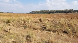 Traveling in areas that are really not far from Jerusalem, but would have been a bit of a distance if you had to
walk, like Biblical times, is the area of Sochoh, where David slew Goliath. Due to the description of the area in
the Old Testament, this is the place, for sure. Now is this cool or what?
Traveling in areas that are really not far from Jerusalem, but would have been a bit of a distance if you had to
walk, like Biblical times, is the area of Sochoh, where David slew Goliath. Due to the description of the area in
the Old Testament, this is the place, for sure. Now is this cool or what?
In this field in this picture, was that epic confrontation. Behind us are the battle lines of the Israelites. In front,
in the hills where the trees are, was where the Philistines were garrisoned.
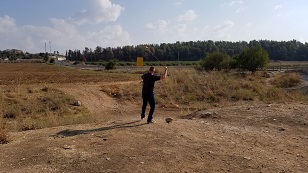 We are at the location where David slew Goliath. Here, our Pastor, Pastor Tony, demonstrates how the ancient sling
shots were used, and how David would have used it to slay Goliath.
We are at the location where David slew Goliath. Here, our Pastor, Pastor Tony, demonstrates how the ancient sling
shots were used, and how David would have used it to slay Goliath.
Get 'em Tony!
 We stop along the road on our tour and look at Bethleham from a distance. The buildings in the back, past the open'
area, is Bethleham. Now, the foreground shows the open area where shephards would have herded their flocks. It was
this area where the Angels proclaimed the birth of the Messiah on that grand, first, Christmas morning!
We stop along the road on our tour and look at Bethleham from a distance. The buildings in the back, past the open'
area, is Bethleham. Now, the foreground shows the open area where shephards would have herded their flocks. It was
this area where the Angels proclaimed the birth of the Messiah on that grand, first, Christmas morning!
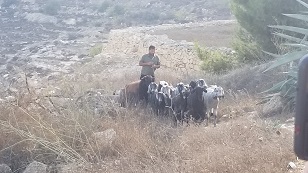 Would you believe it! While were are here, admiring the view and thinking of all this area saw during the time when
Jesus was born, and that the Angels proclaimed to the simple shephards of the birth of the Messiah..
Would you believe it! While were are here, admiring the view and thinking of all this area saw during the time when
Jesus was born, and that the Angels proclaimed to the simple shephards of the birth of the Messiah..
A shephard shows up! And allows us to pet his sheep. We consider that there was several teams of shepherds and sheep, just like this at that first Christmas morning, to hear the words of the Angels.
Of course, being in the year 2018, this shephard was not adversed to ask for donations to pet his sheep and take pictures.
But what a view and a blessing, considering all the scriptures say of this place.
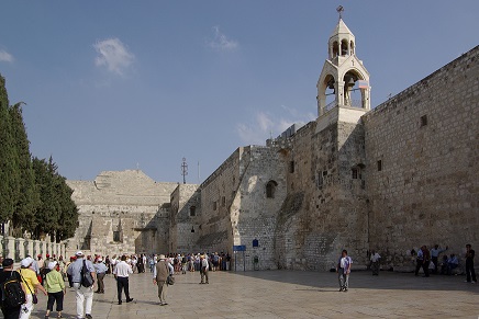 Now here is a picture of the main outside area and entrance to the Church of the Nativity. Christian tradition of
centuries claim that this site is the birthplace of Jesus. But there is no real proof of that.
Now here is a picture of the main outside area and entrance to the Church of the Nativity. Christian tradition of
centuries claim that this site is the birthplace of Jesus. But there is no real proof of that.
Now in the interest of full disclosure, we didn't go to this church on this trip. Bethleham is now in the Arab West
Bank, and our tour guide could not go there safely. That being said, Bill was here 20 years ago on his first trip to
Israel, and it looks just like this.
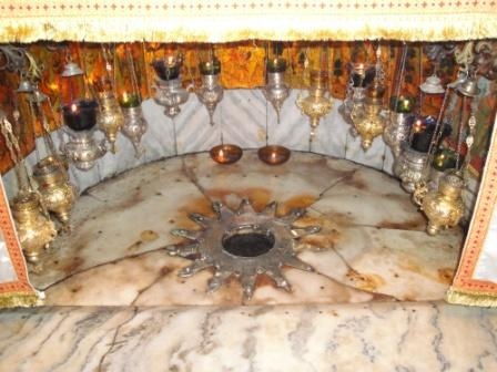 This is a closeup of the area that Christian tradition says, is where Jesus was born. Now, there is no actual
proof or scripture to back this up, but it is the place that tourists and pilgrims go, to thank God for the gift
of his son.
This is a closeup of the area that Christian tradition says, is where Jesus was born. Now, there is no actual
proof or scripture to back this up, but it is the place that tourists and pilgrims go, to thank God for the gift
of his son.
Now you can't tell from this picture, but this area is immediately below the alter area of the Church of the Nativity.
It's in a cave, where, again traidtion says, Jesus was born.
Full disclosure, our tour didn't go to the Church of the Nativity because it's in the West Bank, which is Palestinian
occupied territory. But Bill did go to Israel 20 years ago and this is exactly the area and view from that time. This
particular picture is from the web, because Bill's picture at that time (which looks exactly the same), has some dudes
head in the view. This one is mo-betta.
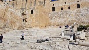 We are now at the outside of the temple mount area, on the south side. These steps in the foregound led up to the
temple mount during Jesus time. Now the access to the temple mount area is blocked because of the Al-Aqsa mosque.
We are now at the outside of the temple mount area, on the south side. These steps in the foregound led up to the
temple mount during Jesus time. Now the access to the temple mount area is blocked because of the Al-Aqsa mosque.
Jesus would have assuridly walked these steps during his time on earth. What a joy and blessing to be here!
hav
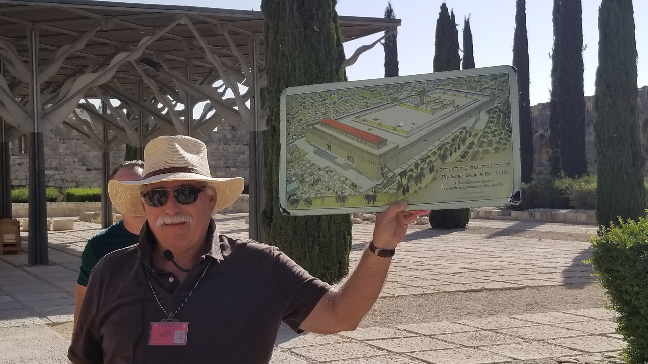 Our fantastic tour guide, Ronney, show us a drawing of the temple mount as we are getting ready to assend the mount
and see the sights.
Our fantastic tour guide, Ronney, show us a drawing of the temple mount as we are getting ready to assend the mount
and see the sights.
Note that the steps we were at in the prior picture are the steps to the left in the picture.
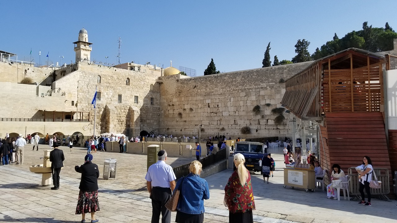 Here we are at the famous Western Wall. This area is on the west side of the temple mount and is the closest that
Jews can get to the temple mount, due to political issues that exist today.
Here we are at the famous Western Wall. This area is on the west side of the temple mount and is the closest that
Jews can get to the temple mount, due to political issues that exist today.
Men pray on the left side, and woman on the right. The opening on the left side is a room, that is under the area
where the steps were that led to the temple mount in Jesus' time. This room has tables and Rabbi's can pray inside.
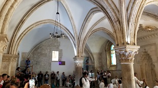 We arrive at the area in Jerusalem that is the destination where Christians hail as the place of the "upper room", where
Jesus instituted communion, where Jesus washed the feet of the disciples, and where Judas left, to turn in Jesus to the
Jewish Sanhedrin.
We arrive at the area in Jerusalem that is the destination where Christians hail as the place of the "upper room", where
Jesus instituted communion, where Jesus washed the feet of the disciples, and where Judas left, to turn in Jesus to the
Jewish Sanhedrin.
Now an astitute observer will be able to tell immediately that the architecture of this room is medieval, not Jewish
or even Roman.
The feeling is that this building was built "on top" of the original building of Jesus' time. But there is no proof of
this and it's unlikely that this is the spot. But it was a blessing to be in the area and reflect on all that the Lord
did at this time. This pilgrims in the picture as doing just that.
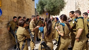 As we walk and see the old city of Jereusalem, we occassionally come across folks like this. We're told that these
are not army personnel, but special police personnel that are authorized to carry heavier weapons and handle security
issues that the "regular" law enforcement police might not be able to handle.
As we walk and see the old city of Jereusalem, we occassionally come across folks like this. We're told that these
are not army personnel, but special police personnel that are authorized to carry heavier weapons and handle security
issues that the "regular" law enforcement police might not be able to handle.
Yes, they look (and are) young. Everyone in Israel must join the military or special enforcement policy units at 18
years old, and these are some of them.
You might think that seeing weaponized militia like this walking around would make you feel uncomfortable, but it is
always good to see the Israeili security forces around.
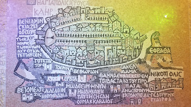 Here is a famous drawing/map of Jerusalem around the Byzantine era, drawn as a floor mosaic, called the Madaba map.
Might have been a map for people living at the time to navagate around the city.
Here is a famous drawing/map of Jerusalem around the Byzantine era, drawn as a floor mosaic, called the Madaba map.
Might have been a map for people living at the time to navagate around the city.
This picture is popular in books and documentaries discussing ancient Israel, and we're privilaged to be able to come
see it and get a picture ourselves.
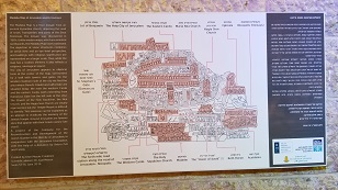 Archeological notes about the Madaba Map pictured above, along with reference points noted from the map.
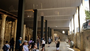 Ajacent to the Madaba Map is the ruins of a portion of a Roman colonnade from the first century, and probalby earlier, during the time of Christ. We are about 30 feet below today's street level in this area. This was a major street with shops and a place of discourse for the local poeple at the time.
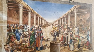 Here is an artists view of what this same colonnade looked like ancient times, when it was being used. What an
experience to be able to walk down this street for a few minutes and take in what it must have been like back then!
Here is an artists view of what this same colonnade looked like ancient times, when it was being used. What an
experience to be able to walk down this street for a few minutes and take in what it must have been like back then!
 We are in the Jewish quarter of the old city and here is a location where a Jewish organization - think it's the police
force, are recruiting and fund raising.
We are in the Jewish quarter of the old city and here is a location where a Jewish organization - think it's the police
force, are recruiting and fund raising.
All the ladies in our group want to donate and get a picture with this guy. Women love a man in uniform!
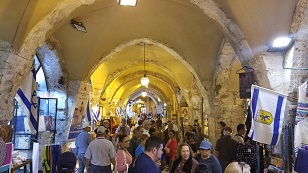 Here we are walking down one street that is a shopping area with shops on both sides. This is a good example of just
about all the stopping areas, Jewish quarter, Arab quarter, Christian quarter, or whatever, that we saw in the old
city. They look like ruins of byzantine or medieval structures, but I'm not sure.
Here we are walking down one street that is a shopping area with shops on both sides. This is a good example of just
about all the stopping areas, Jewish quarter, Arab quarter, Christian quarter, or whatever, that we saw in the old
city. They look like ruins of byzantine or medieval structures, but I'm not sure.
This particular one is in the Jewish quarter, as you can tell from the flag to the right of the picture.
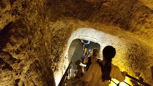 We are not entering Warrens Shaft. This shaft is named after the 19th century archeologist who discovered it. What
it is, is a shaft down into the ground on the east side of the old "king David" city. If you recall from seeing pictures
above of the model of Jerusalem, this area is to the left of the temple mount area, looking east to west.
We are not entering Warrens Shaft. This shaft is named after the 19th century archeologist who discovered it. What
it is, is a shaft down into the ground on the east side of the old "king David" city. If you recall from seeing pictures
above of the model of Jerusalem, this area is to the left of the temple mount area, looking east to west.
There are actually two tunnels in this location. ON was built in the 1800 B.C. era to access water on the east side of the city. The other was built around 700 B.C. It was necesseary to be able to get to water from WITHIN the city walls, in case of siege of the city. So this shaft was built vertically, and then another one horizontally, to reach the water supply to the east of the city, from underground.
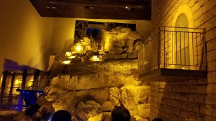 Down in Warran's shaft (30+ feet below moden day ground level) is the ruins of a tower and wall that dates to the time
of the Canaaites. The Canaaites lived in the city, that one day would be called Jerusalem, before the Israelites took
over the city.
Down in Warran's shaft (30+ feet below moden day ground level) is the ruins of a tower and wall that dates to the time
of the Canaaites. The Canaaites lived in the city, that one day would be called Jerusalem, before the Israelites took
over the city.
The city was taken over by Kind David by invading and taking over the city from the Canaaites. He did this by having
one of his men sneak into the city via this water system and open the city gates from within (see notes on that below).
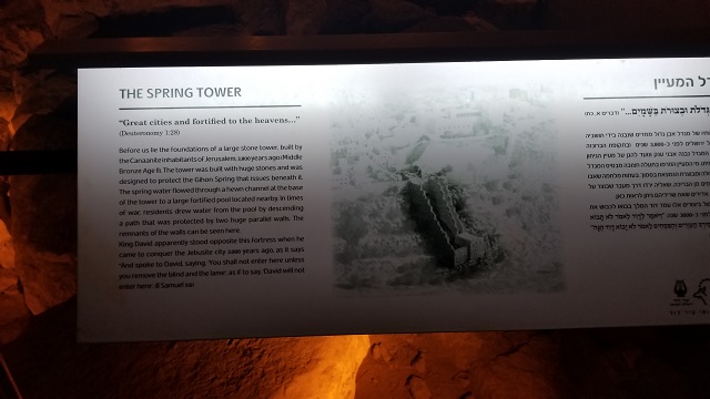 Notes displayed here for tourists about the Canaaite wall, the shaft, water supply, etc. Very intersting.
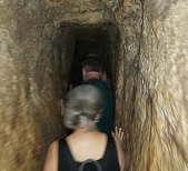 Beyond the (now underground) ruins of the Canaaite wall are two shafts that brought water into the city, built about
1000 years apart. One still has water running in it (up to ankle deep) and one is dry now. Our interepid group
splits up into those that go dry and those that go wet. Bill and Adelina go wet, the Siloam tunnel.
Beyond the (now underground) ruins of the Canaaite wall are two shafts that brought water into the city, built about
1000 years apart. One still has water running in it (up to ankle deep) and one is dry now. Our interepid group
splits up into those that go dry and those that go wet. Bill and Adelina go wet, the Siloam tunnel.
The water is cold at first, but refreshing soon thereafter. Here is a picture of our "wet" group going through the
tunnels built to bring water in from the outside, into the city, during times of siege.
This looks narrow and it is. But it get's narrower and shorter in other places, than this! No lights, so flashlights
or tightly held phones do the trick.
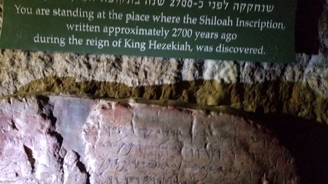 In the Siloam tunnel, we find the famous Shiloah inscription. This is writing placed there during King Hezekiah's time
(King Hezekiah is mentioned in the Bible, and again, the Bible's historical accuracy is shown).
In the Siloam tunnel, we find the famous Shiloah inscription. This is writing placed there during King Hezekiah's time
(King Hezekiah is mentioned in the Bible, and again, the Bible's historical accuracy is shown).
This inscription commemorates the completion of this tunnel, around 700 B.C.
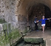 We make it out the tunnel! About 1/4 mile. In the foreground are the ruins of the pool and water storage area
where the water was stored from the tunnel for city use.
We make it out the tunnel! About 1/4 mile. In the foreground are the ruins of the pool and water storage area
where the water was stored from the tunnel for city use.
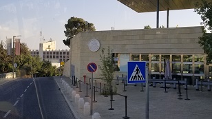 Upon leaving the area of the old city of David and the water tunnels, we drive by the new U.S. Embassy recently
relocated from Tel Aviv to Jerusalem by the Trump Administration.
Upon leaving the area of the old city of David and the water tunnels, we drive by the new U.S. Embassy recently
relocated from Tel Aviv to Jerusalem by the Trump Administration.
It is a source of joy for Israeli citizens, and helps validates Israeli claims that the entire city of Jerusalem is a
permanent part of the nation of Israel.
 After we get back to our hotel, freshen up, and have dinner, we decide to walk off our dinner with a quarter-mile
walk to a local shopping mall. Very popular it appears. Nice place.
After we get back to our hotel, freshen up, and have dinner, we decide to walk off our dinner with a quarter-mile
walk to a local shopping mall. Very popular it appears. Nice place.
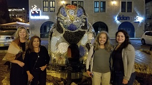 Mosaic of a cat along the street, in front of a hotel, makes a great spot for a picture of our troop of tourists
visiting Jerusalem shopping malls. The weather this time of year is great, and only a light sweater was needed
at night.
Mosaic of a cat along the street, in front of a hotel, makes a great spot for a picture of our troop of tourists
visiting Jerusalem shopping malls. The weather this time of year is great, and only a light sweater was needed
at night.
We have, left to right, Anna, Adelina, Mimi, and Katie. Bill is taking the picture.
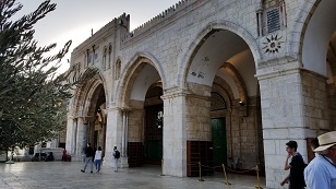 Early the next, and final day, morning, we go to the temple mount. Demand for coming on the mount for tourists is very
large, so we get here early before the crowds. Here is the Al-Aqsa mosque. It is built on the south end of the
temple mount area.
Early the next, and final day, morning, we go to the temple mount. Demand for coming on the mount for tourists is very
large, so we get here early before the crowds. Here is the Al-Aqsa mosque. It is built on the south end of the
temple mount area.
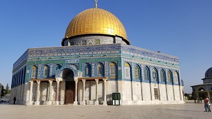 Just north of the Al-Aqsa mosque on the temple mount area, is the iconic Dome of the Rock, which is featured in all
pictures of the temple mount because of it's height and gold dome. It is at this site, according to Islam, that
Mohammad floated up to heaven.
Just north of the Al-Aqsa mosque on the temple mount area, is the iconic Dome of the Rock, which is featured in all
pictures of the temple mount because of it's height and gold dome. It is at this site, according to Islam, that
Mohammad floated up to heaven.
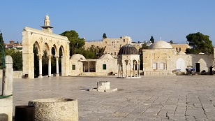 Now this is an interesting area, although it doesn't look interesting. It is on the temple mount, immediately north
of the Dome of the Rock. What do you see? Well, not much, because it's an open area. That little domed shrine in
the center of the picture is the place, some say, where the temple's Holy of Holies place (location where God dwelt)
was located! (Note there is much more room to the right of the picture not shown).
Now this is an interesting area, although it doesn't look interesting. It is on the temple mount, immediately north
of the Dome of the Rock. What do you see? Well, not much, because it's an open area. That little domed shrine in
the center of the picture is the place, some say, where the temple's Holy of Holies place (location where God dwelt)
was located! (Note there is much more room to the right of the picture not shown).
The Bible clearly teaches that another temple will be build on the temple mount. The Apostle John, in Revelations, is
asked to measure the temple, but not the outside, as that was given over to the Gentiles. So it is believed by many
that the new temple, built in the future, will be build in this open area, seperated from the Dome of the Rock, which
is given over to the Gentiles.
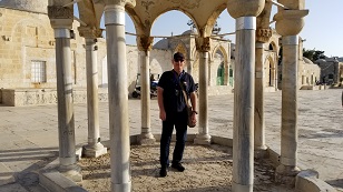 Here is Bill, standing in the Dome of the Spirits, a small dome on the north side of the temple mount where many
people believe the future Jewish temple will be. The east gate of the temple mount, leading off to the Mount of
Olives, is to the back of the picture, a bit to the right.
Here is Bill, standing in the Dome of the Spirits, a small dome on the north side of the temple mount where many
people believe the future Jewish temple will be. The east gate of the temple mount, leading off to the Mount of
Olives, is to the back of the picture, a bit to the right.
You may recall ealier commentary about the east gate, where a picture showed it to be bricked up. Muslim's did this
during the middle ages when they had control of the area to prevent Jesus from coming in. The Bible teaches that Jesus will once again enter this Holy City and area via the east gate, as he did the first time on the day we call "Palm Sunday".
It is a real privilage to be standing on this Holy place - the CENTER of God's future kingdom on earth, according to
the Bible!
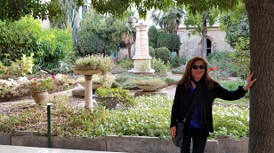 We are very fortunate to be able to walk a short way to a private, garden area, away from the crowds, for reflection
and devotional. This is the garden outside of the building that is calledSaint Anne's house.
We are very fortunate to be able to walk a short way to a private, garden area, away from the crowds, for reflection
and devotional. This is the garden outside of the building that is calledSaint Anne's house.
Saint Anne's house is built on the place where tradition days that Mary, the mother of Jesus was born. There
is no proof of this, but many of the reverant come to see the place. And if it provides spirtual growth, so be it. What a wonderful, peaceful place!
Here a very beautiful Adelina with a portion of the flower garden.
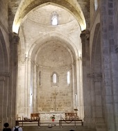 The actual location of the place where Mary was born is below the St. Annes House, as was traditional for churches and other structrures built on Holy site locations. Also, street level in Jesus' time was 30 feet below street level today, so you'd expect that if, in fact, the location was the actual one.
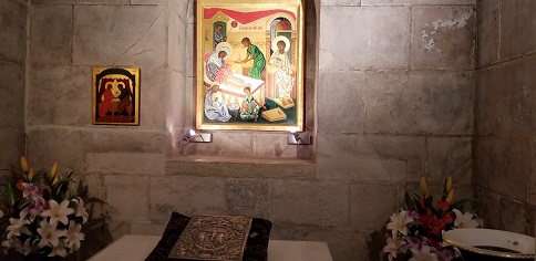 Here is the location, according to tradition, where Mary, the mother of Jesus, was born. It is below Saint Anne's
house, and surrounded by a lovely garden.
Here is the location, according to tradition, where Mary, the mother of Jesus, was born. It is below Saint Anne's
house, and surrounded by a lovely garden.
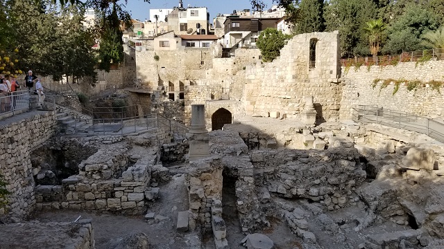 As we depart the wonderful, quite, garden area, where we had a chance for a devotional by our leader Gene, and quiet
time for reflection from all we've seen, we have a chance to see more ruins from the time of Jesus. You can see
that the ruins are 30 or so feet down, because that is where the street and ground level was at that time.
As we depart the wonderful, quite, garden area, where we had a chance for a devotional by our leader Gene, and quiet
time for reflection from all we've seen, we have a chance to see more ruins from the time of Jesus. You can see
that the ruins are 30 or so feet down, because that is where the street and ground level was at that time.
Here are the ruins of the pools of Bethesda! What a privilage to be here and see this amzing place. Jesus was here
many times and performed healings here. The reader is referred to John 5:1-15.
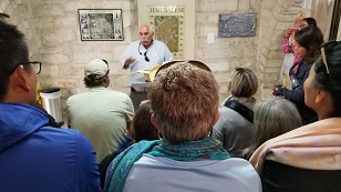 We walk through some of the streets that comprise the Via Dolorosa, "The Way of Sorrow". Tradition says this is the
path that Jesus took from his final trial and scouraging at the Antonia Forturess (building on the north west side of
the temple mount, if you remember from the previous Jersusalem model pictures).
We walk through some of the streets that comprise the Via Dolorosa, "The Way of Sorrow". Tradition says this is the
path that Jesus took from his final trial and scouraging at the Antonia Forturess (building on the north west side of
the temple mount, if you remember from the previous Jersusalem model pictures).
A number of Biblical scholars would probable disagree that the entire route was walked by Jesus on his way to Golgatha,
but he must have walked on some, and it's a blessing in any case.
Here we are in a private area under guardianship of Christian Nuns. It is the entryway to the ruins of the Antonia
Fortress. Jesus WAS in this building and no doubt in the lower section where prisoners were kept.
Here Ronney, our tour guide, briefs us of the Antonia Forturess, what we can expect, and what happened here, according
to the scriptures and historical accounts.
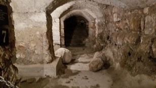 Walkways and entryways in the Antonia Fortress, where the Roman garrison was headquarted in Jerusalem. Did Jesus
walk this path and walk through these entryways. There is no proof, but he must have, since he was held here during
is trial.
Walkways and entryways in the Antonia Fortress, where the Roman garrison was headquarted in Jerusalem. Did Jesus
walk this path and walk through these entryways. There is no proof, but he must have, since he was held here during
is trial.
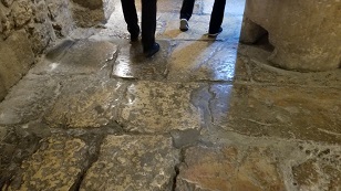 These stones that we walk on, that make up the floor of the Antonia Fortress, ARE the stones that were there during
Jesus' time. He MUST have walked them, as we do! What a privilage to be here!
These stones that we walk on, that make up the floor of the Antonia Fortress, ARE the stones that were there during
Jesus' time. He MUST have walked them, as we do! What a privilage to be here!
 An interesting stone is found down here in the Antonia Fortress. It shows a game "board" that was carved into the
stone and would have been played by Roman army people during their time off.
An interesting stone is found down here in the Antonia Fortress. It shows a game "board" that was carved into the
stone and would have been played by Roman army people during their time off.
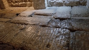 Here we come to a street. It's below ground now and accessable from the Antonia fortress without going outside
because the north wall of the Antonia fortress in this area is missing over time.
Here we come to a street. It's below ground now and accessable from the Antonia fortress without going outside
because the north wall of the Antonia fortress in this area is missing over time.
Jesus would have been lead out to Golgatha from here. He almost assuradly walked this street!
Notice also the grooves in the stones. This was rain runoff, so the stones would drain of water and not have standing
water on them, causing people to slip and fall. Pretty slick those Romans...
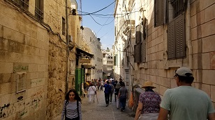 One of the streets of the Via Dolorosa. Just outside the Antonia Fortress, so it's very possible Jesus walked
this area. Of course, the street probably looks a lot differently now then during Jesus time.
One of the streets of the Via Dolorosa. Just outside the Antonia Fortress, so it's very possible Jesus walked
this area. Of course, the street probably looks a lot differently now then during Jesus time.
Also, it must be remembered, that this street is the AREA where Jesus might have walked, but higher up. Actual street level in Jesus time was 30 feet below this point.
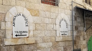 Signs of the Via Dolorosa stops along the street as we walk.
 We arrive at the Church of the Holy Seplachur. It is at this location that many believe Jesus was crucified and buried,
being that the scripts state that Jesus was buried a short distance from where he was cruicified.
We arrive at the Church of the Holy Seplachur. It is at this location that many believe Jesus was crucified and buried,
being that the scripts state that Jesus was buried a short distance from where he was cruicified.
This place is super busy and it's very difficult to even get inside the church.
It should be noted that there are two competing locations where it is believed that Jesus was cruicified. The site
of this church is one of them, and is a reverant place for many Christians.
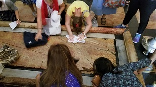 As we enter the Church of the Holy Seplachur, we literally fight our way to the first structure inside. This is a
slab of rock, which tradition says is where Jesus' body was laid after being taken down from the cross, and where
he was wrapped in burial cloth.
As we enter the Church of the Holy Seplachur, we literally fight our way to the first structure inside. This is a
slab of rock, which tradition says is where Jesus' body was laid after being taken down from the cross, and where
he was wrapped in burial cloth.
It is also a tradition that if you or something you own and touch the slab, it will be blessed. Adelina is in the
foreground here. Regardless of if this was where Jesus was laid after he died, it is a blessing to so many people,
as we can see. That makes it important no matter it's historicity.
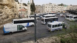 We are greatly privilaged to be able to enter the Garden Tomb area. Owned and maintained by a Christian organization,
this area is close to the second location where Jesus is believed to have been crucified. Here, on the east side
of the Garden Tomb property, we see a bus depot.
We are greatly privilaged to be able to enter the Garden Tomb area. Owned and maintained by a Christian organization,
this area is close to the second location where Jesus is believed to have been crucified. Here, on the east side
of the Garden Tomb property, we see a bus depot.
This area is outside the Damascus gate, on the road to Damascus, on a hill, and against a rock wall with the appearance of a face or skull (in Greek, Golgatha). This seems to much better fit the location of the site of the crucifixion than the Church of the Holy Seplachur.
Since the Jews don't see Jesus as their real messiah, they do not take the trouble to do archeological digs or hold
these sites reverant, unless Christian organizations are able to do it. Not likely in this area, since it looks like
this bus depot is a valuable place for local public transportation.
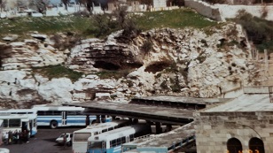 Over the years, weather has eroded the face/skull on the side of the hill. When Bill was here 20 years ago, there
was less erosion (I'm guessing weather pattern changes, and local construction has increased the degradation of the
face/skull on the hill), and so the skull image can be seen better in the past.
Over the years, weather has eroded the face/skull on the side of the hill. When Bill was here 20 years ago, there
was less erosion (I'm guessing weather pattern changes, and local construction has increased the degradation of the
face/skull on the hill), and so the skull image can be seen better in the past.
Here is a much better view and picture of the skull image on the side of the hill, at Golgatha; "The place of the skull", taken by Bill 20 years ago and from a better angle.
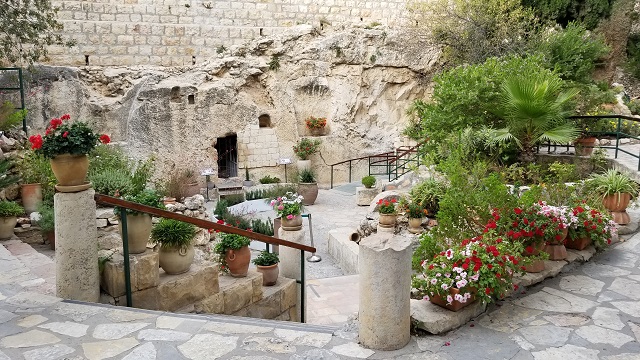 Here is the entrance to the guarden tomb. No guarentee that THIS was the place where Jesus' body was laid, but it is a
definite possiblity. It is near the place of the skull, was a garden tomb in Jesus time close by (including a roman fountain found here). Also, the scriptures speak of the diciples having to look to the right when entering the tomb to see if Jesus' body was gone, which is what you would have to do in this tomb.
Here is the entrance to the guarden tomb. No guarentee that THIS was the place where Jesus' body was laid, but it is a
definite possiblity. It is near the place of the skull, was a garden tomb in Jesus time close by (including a roman fountain found here). Also, the scriptures speak of the diciples having to look to the right when entering the tomb to see if Jesus' body was gone, which is what you would have to do in this tomb.
Most tombs of this type had the location where the body was laid straight ahead of the enterance, not to the right.
What a beautiful, peaceful place. What a blessing to be here!
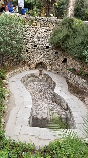 Here is the Roman fountain design that is found just a few feet from the tomb itself. This is a validation that this
area was in operation during Roman times, was owned by a wealthy person, had a tomb in the area, with the location very close to Golgatha.
Here is the Roman fountain design that is found just a few feet from the tomb itself. This is a validation that this
area was in operation during Roman times, was owned by a wealthy person, had a tomb in the area, with the location very close to Golgatha.
 Back at hotel after our last day of touring. Some flights (including ours) leave early, so goodbyes are made now,
once we're back at our hotel.
Back at hotel after our last day of touring. Some flights (including ours) leave early, so goodbyes are made now,
once we're back at our hotel.
Here Gene (on the right) says goodbye to Ronney. Gene was a Biblical guide, provided our devotionals, and Bible
references as we toured (he is part of our church). Ronney is an Israeli citizen and was our official tour guide.
Ronney gave us all the historical information of what we say and make sure we were taken care of on our wonderful tour.
Thank you both and God bless you both for all you did for us on this fantastic visit to God's land!
 On our trip home, as we change planes in Istanbul, we see a cute scene of a little boy holding hands with this sister
and showing her around the airport. God bless them both!
On our trip home, as we change planes in Istanbul, we see a cute scene of a little boy holding hands with this sister
and showing her around the airport. God bless them both!